Photography Tutorial · 2021-03-21
How Are These Landscape Compositions Found? A Location-Scouting Tutorial
Thomas Chu Photo
Technological progress boosts work efficiency — and landscape photography is no exception.
Friends often ask how I keep discovering fresh compositions and unusual vantage points.
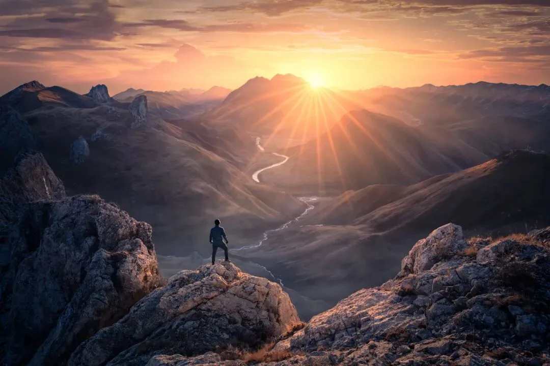
In today's video tutorial, Thomas uses four case studies to show how drones help with location scouting and landscape exploration.
Video Tutorial
▶ Watch the video tutorial on Bilibili
This is the fully illustrated companion to the video above. The photos in the intro were all shot on the ground with phones and cameras — yet every one of those locations was first scouted from the air with a drone. In this episode Thomas walks through four real cases — a Tibetan sunrise, a Laigu Glacier ice cave, star trails over the 72 Bends of the Sichuan-Tibet highway, and textures on a frozen lake — to demonstrate his complete drone-based location scouting workflow.
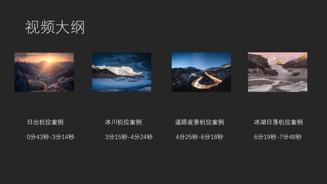
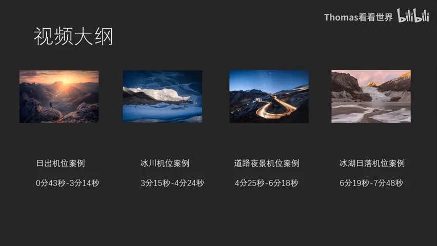
Start with the outline: this summary slide, captured at 0:31 in the video, lines up the four cases — a sunrise location, a glacier location, a night-road location, and a daytime frozen-lake location, each with its own time code. They are unpacked below in the same order.
01 The Core Rule: Background First, Then Midground, Foreground Last
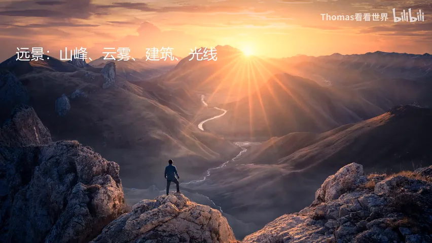
When scouting with a drone, Thomas follows a fixed order: find the background first, then the midground, and the foreground last (at 1:14 in the video). The logic is that the background — a mountain range, say — is fixed: it will not change no matter where you stand. Locking the best background angle from the air first makes the whole search efficient.
Each layer has its own candidate checklist: peaks, mist, buildings and light for the background; rivers, grasslands, forests and villages for the midground; flowers, rocks, ice and people for the foreground (at 1:16 in the video). Pair the layers against these lists while scouting in the air, and the skeleton of a photograph takes shape.

02 Case One: A Sunrise Composition in Laqu, Tibet
The first case is in Laqu, Tibet. Thomas had come to photograph a Tibetan Buddhist monastery at the foot of the mountain, but once the Mini 2 was airborne he flew off to the side first, as always, to check for other compositions (at 0:54 in the video). Sweeping the horizon, he confirmed the distant snow mountains were dimensional and layered, spotted small pastures on the hillside as a midground, and marked the slope itself — and the flowers it might hold later — as foreground material (at 1:40 in the video).
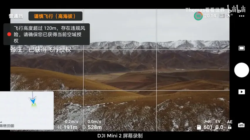
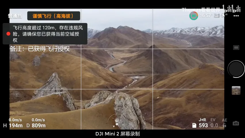
He then yawed the drone through a full 360 degrees to see which direction held the most beautiful mountains — and found it: a sharp yellow peak in the center flanked by rolling snow ranges (at 2:13 in the video). Flying forward, he discovered a river that could serve as a leading line, and with that, both background and midground were secured (at 2:25 in the video).
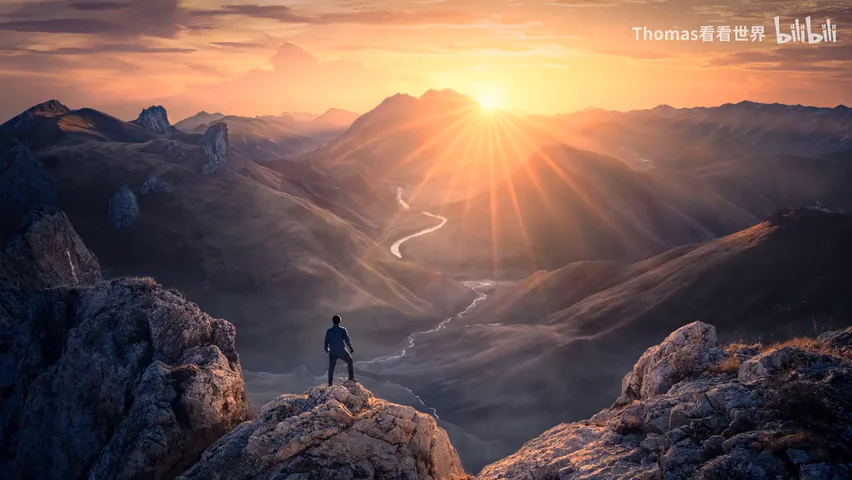
The foreground proved hardest. Being winter, the pastures were bare — using one would mean pitching a tent or placing a person in frame. Then he noticed rocks in the distance: from this position a rock could carry the foreground with a person standing on it, and up close the rock itself had texture and layering that would give the shot yet another feel (at 2:35 in the video). The final image was made the next morning, after climbing onto that very rock (at 3:05 in the video).
03 Case Two: Laigu Glacier — Narrow the Search First
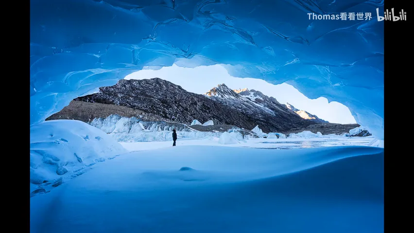
The second case is an ice cave on the Laigu Glacier. The frozen lake freezes over whole and vast — without a drone to shrink the search area beforehand, finding an ice cave on foot is nearly hopeless (at 3:19 in the video). Thomas simply flew up: sweep a rough perimeter first, then lock onto the promising ice blocks (at 3:35 in the video).
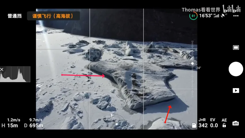
Which blocks hide a cave underneath? The test is remarkably simple: look for an overhang — hollowed in below, bulging out on top (at 3:56 in the video). The glaciers the arrows point to at 4:05 all show this trait and are worth a look; one block in particular bulges far out above, and lying under it with a wide-angle lens produces exactly the ice-cave effect (at 4:15 in the video).
04 Case Three: Star Trails over the 72 Bends
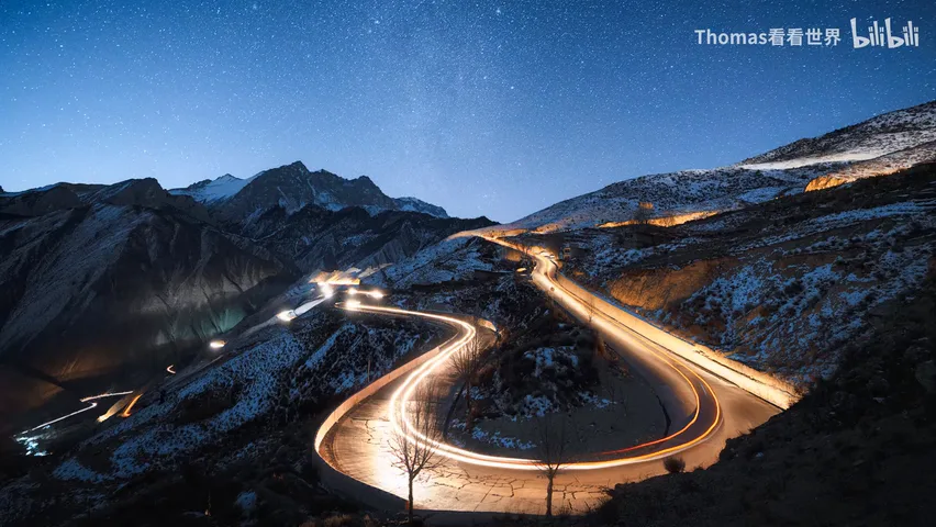
The third image is of the 72 Bends on the Sichuan-Tibet highway. Everyone shoots the grand panorama from the viewing platform; the photos are beautiful but a bit interchangeable, and the scene itself reads slightly messy (at 4:41 in the video). Thomas flew the drone as usual, and the first move was again to study the surrounding background — which angle, which direction worked best (at 4:51 in the video).
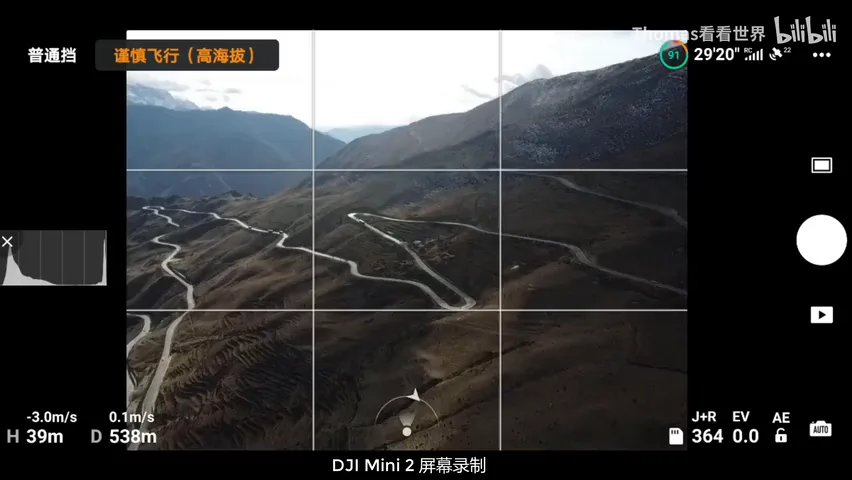
The elimination is visual: the nearby hills in this direction are bare dirt mountains, too close — no good; pick a bend as foreground and the backdrop is another big dirt slope — pointless (at 4:58 in the video). He settled on the distant cluster of sharp, layered snow mountains as his background, then hunted the near field to match — ideally a bend pointing straight at those peaks (at 5:15 in the video).
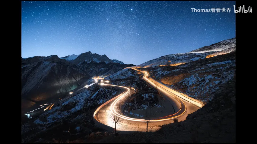
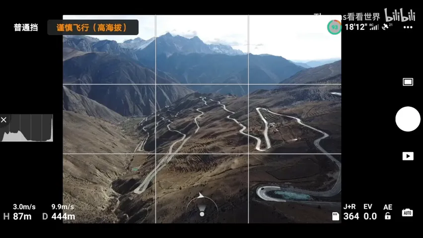
With the background fixed, the candidates narrowed to two bends, lower-left and right. Scouting each with the drone, he found the right bend had a slope where a tripod could stand (at 5:44 in the video); checking the Milky Way's position in an app, it would sweep parallel right over the snow mountains that night (at 5:51 in the video) — angle, landform, and sky aligned.
The night execution was unglamorous: park the car somewhere safe near the point, hike up the slope, and shoot the light trails against the starry sky (at 6:05 in the video). Ten minutes of drone scouting in daylight decided the entire quality of the hours spent shooting at night.
05 Case Four: Frozen Lake by Day — Fly First, Walk Later
The final case is a frozen-lake-and-mountains photo, built on a habit: on arriving anywhere, fly the drone first and look around for the best camera position (at 6:25 in the video). He sent it left first to check for plants or other foreground — and found nothing but barren flats. So no walking search on that side at all; the focus went straight to the snowy ground on the right (at 6:44 in the video). A few minutes of flying saved a pointless hike.
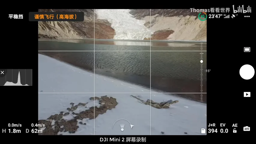
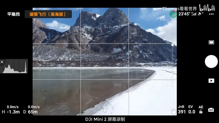
With few people around, he brought the drone down to about 10 meters for a close inspection, well within safe practice (at 6:58 in the video). At low altitude he audited the foreground candidates one by one: any frozen lake surface, any good texture? A dead tree turned up — honestly, "so-so," a fallback only if nothing better appeared (at 7:13 in the video).
Pushing on, he spotted ice forming along the water's edge; from the drone's low pass, the frozen surface already showed texture (at 7:33 in the video). The final frame was made right on the ice, with those natural patterns as the foreground (at 7:44 in the video) — a texture found from the air became the fulcrum of the photo.
06 Wrap-up: The Drone as a Scouting Tool
Thomas sums up the drone's value to landscape photography in two layers. The first is aerial photography itself: a completely different perspective, bird's-eye compositions (at 7:56 in the video). The second matters more: whether the final shot comes from the air or the ground, the drone is a modern scouting instrument — one that maps local terrain, finds better angles, and turns up fresh, never-photographed locations (at 8:04 in the video).
Worth noting: all four cases were scouted and flown with the new compact DJI Mini 2 (at 8:27 in the video). The gear bar for location scouting is low — the method is what counts: background, midground, foreground, in that order, and always fly a lap first when you arrive.
1. The iron rule of scouting: background first, then midground, foreground last — each layer with its own candidate checklist; 2. Sweep wide, then lock onto targets — an ice cave hides under an overhang: hollow below, bulging above; 3. Locations are chosen by elimination: fix the background, then verify the bend's facing, tripod-able ground, and Milky Way azimuth before committing to a night shoot; 4. Fly a lap on arrival: map the dead ends, lock the promising zone, then drop to 10 meters to inspect foreground texture.