Photography Tutorial · 2018-12-23
The World's Most Breathtaking Snow Mountains and Glaciers Are Right Here!
Thomas Chu Photo
In the Karakoram range on the China-Pakistan border, four 8,000-meter peaks and several world-class glaciers are densely nurtured.
Let's learn about this mysterious landscape through the video of post-90s photographer Ayu and the article of professional traveler Thomas!
Short film: The Zenith of K2 (巅峰)
Short film shooting & production: Ayu (阿裕)
Weibo ID: @AyuPhoto
HD link: http://u6.gg/g3zg5
BGM:The Hero's Journey
Shooting Equipment
Camera: a7r2 + a7s2
Lenses: FE 70-200mm/f4, Laowa 12mm/f2.8, Sigma 35mm/f1.4
Stabilizer: Zhiyun Crane 3 Lab, Rider-M
Drone: Phantom 4 Pro
Slider: Syrp Genie (Syrp大精灵)
Travelogue: The Karakoram Discovery Journey
Photos & text: Thomas Chu Photo
Editing & proofreading: Editorial office of Global Human Geography (《环球人文地理》)
First published in: Global Human Geography (《环球人文地理》)
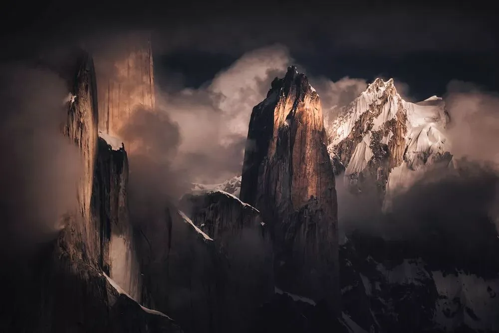
It was in 2013 that, by chance, I discovered that beyond the Himalayas, the Karakoram range in Pakistan nurtures four 8,000-meter peaks and countless giant summits above 6,000 or 7,000 meters, and even several world-class non-polar glaciers gather here. This fired up my passion for photographing snow mountains, and from then on, Pakistan topped my dream list.
Unfortunately, mundane matters kept me busy. It wasn't until 2016 that I finally went to Pakistan with my teammates to complete the long-awaited "K2 Base Camp Trek."
Qogir Peak, also known as "K2," is second only to Mount Everest in height, but its changeable weather and steep profile make it far harder to climb than Everest, earning it the reputation of "the Savage Mountain."
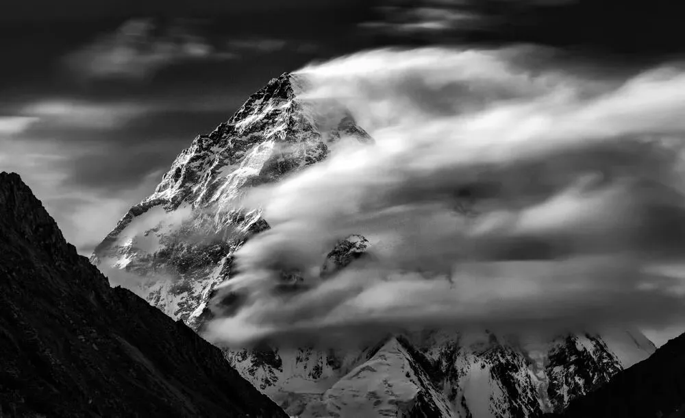
Even though the trek was arduous, I returned here twice more afterward. This made my friends curious: what charm does Pakistan hold that draws me back again and again to shoot?
The reason is simple: here lie the world's most rugged snow mountains, most magnificent glaciers, and most changeable cloud-and-mist weather. Every adjective pales before the Karakoram range.
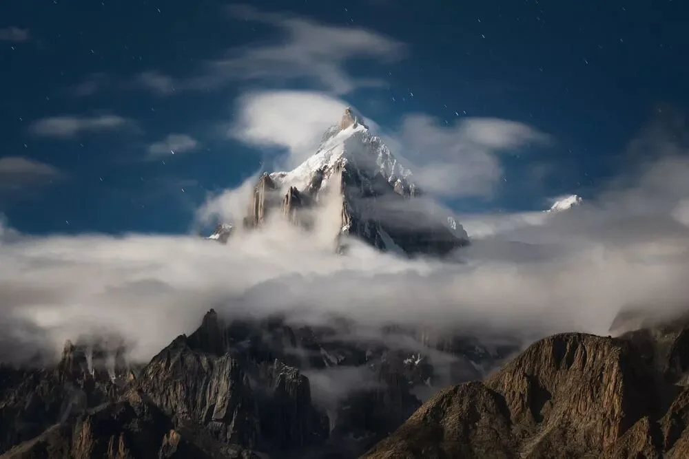
Every year I return here, I find new shooting positions, discover new compositions, and generate new inspiration. This magical land is not only a paradise for mountaineers and trekkers, but also a heaven for landscape photographers.
Visiting the Skardu White Desert
Trekking Through the River Valley on Soft Ground
Unlike trekking in Nepal, where the route is lined with inns and villages, making supplies and lodging very convenient and requiring no guides or porters, the entire K2 Base Camp trek route runs through river valleys and glaciers — a truly uninhabited area. All supplies and provisions must be carried in by human labor, and guides are essential.
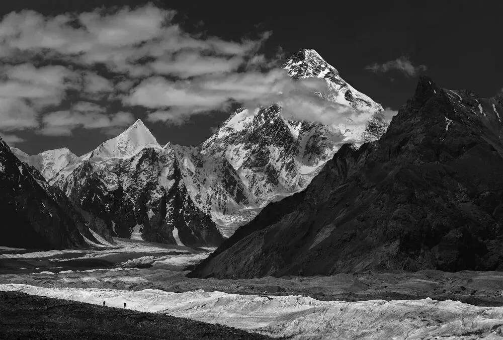
In addition, because the trek route lies in a sensitive border zone where Pakistan meets China and India, various complicated formalities are required. So we contacted a local trekking company to arrange our itinerary and organize a team of guides and porters.
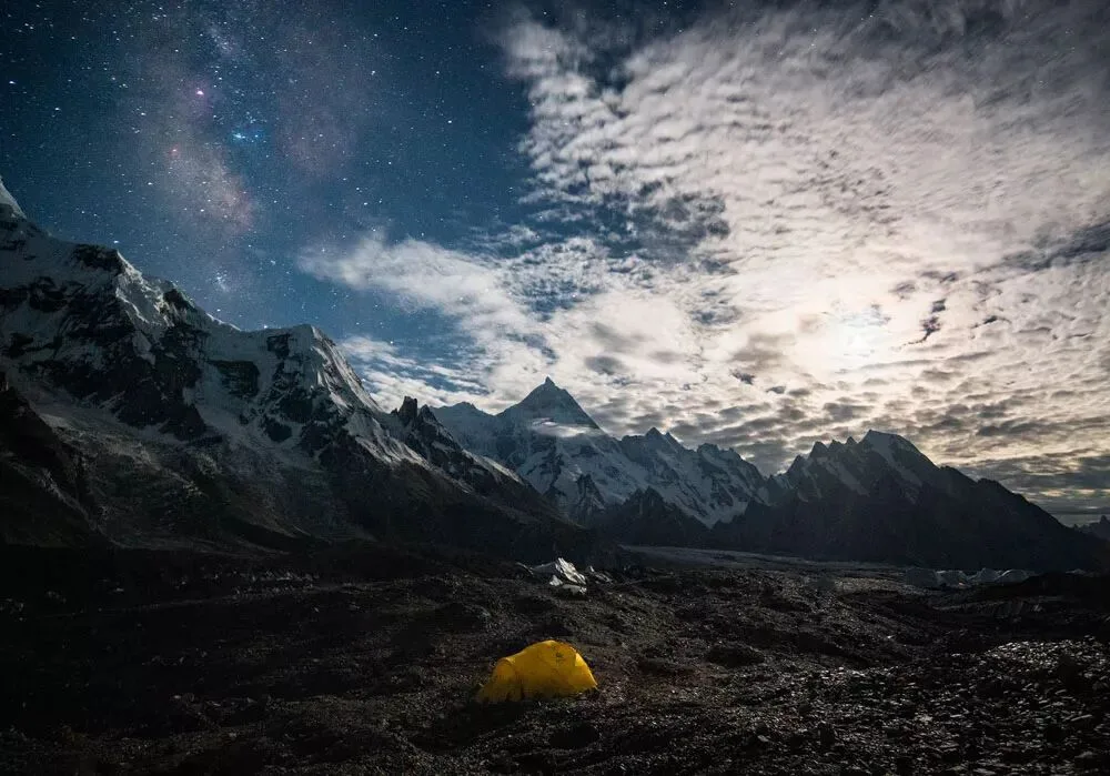
We flew from Urumqi to Islamabad, Pakistan, then headed to Skardu, an important town in the country's north. Although Skardu sits in an arid valley, it's a lush green oasis surrounded by mountains, with clear winding rivers — a different kind of desert charm. Here, we generally needed to rest for 1-2 days while waiting for the military and local tourism bureau to process the trekking formalities.
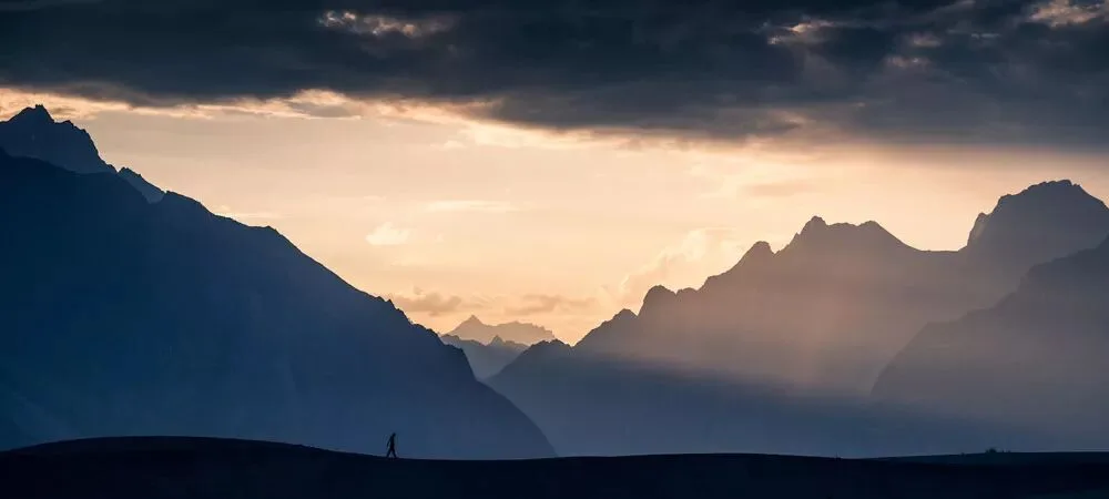
During the rest, we visited Skardu's famous White Desert. The best time to shoot the White Desert is in the afternoon when there's side-backlighting, because it makes the photos more three-dimensional and layered.
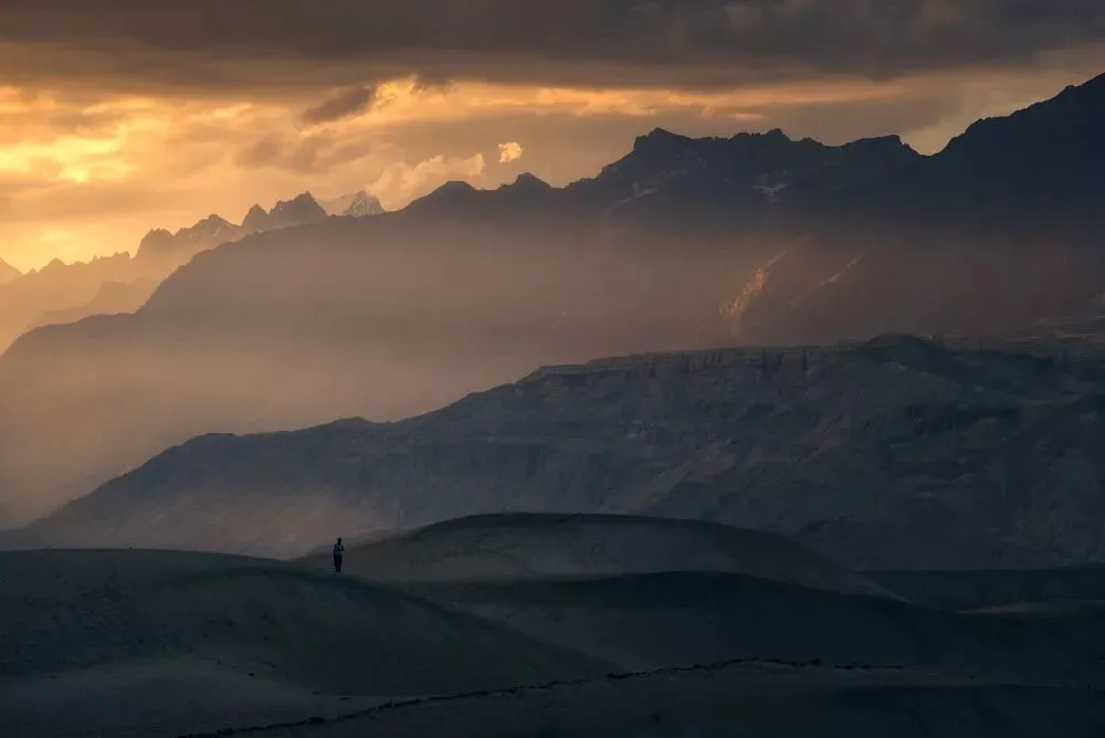
As the sun set, fiery clouds glowed with golden light, sand dunes rippled layer upon layer, and the desert stretched in endless ridges. The vast canyon was draped in a thin veil like light clouds — perhaps drifting sand mist, perhaps dim golden afterglow — and between light and shadow, the bleakness of a waning sun shone through.
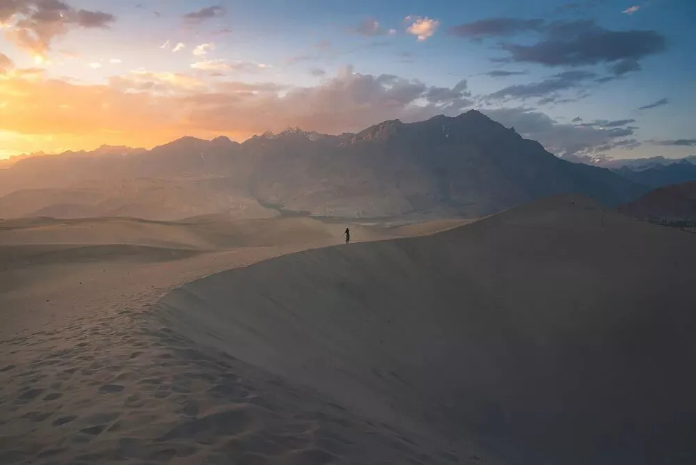
After completing the formalities and recruiting the porters, our summit photography journey officially began.
On the first day, the trek stretched 21 kilometers, and we kept trekking through the river valley. The heavens wasted no time giving us a stern warning: though the peaks were towering and desolate, the dry and scorching weather was unbearable, with temperatures staying above 30 degrees.
Along the way there were no very steep slopes, but many sections were fine sand left by the river valley's wash. Anyone with a bit of trekking experience knows: it's not the long road that worries you, but the soft ground. Wearing trekking boots on sand, your legs can't get any leverage, and each step sinks unevenly — enough to drive you to despair.
Moreover, the sand was mixed with many loose rocks, so we had to stay fully focused while walking; a moment's inattention could sprain an ankle, and spraining an ankle here would mean the entire journey was ruined.
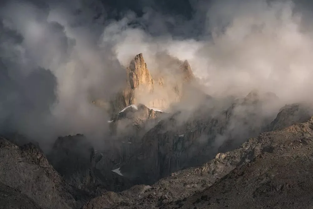
Fortunately, after 2 hours of trekking, we saw Pakistan's version of "Patagonia," which brought us great comfort: in the distance stood proud peaks — some with thick glaciers hanging from their summits, others with bodies as rugged as if hewn by blades and axes. The perilous terrain and steep slopes were awe-inspiring.
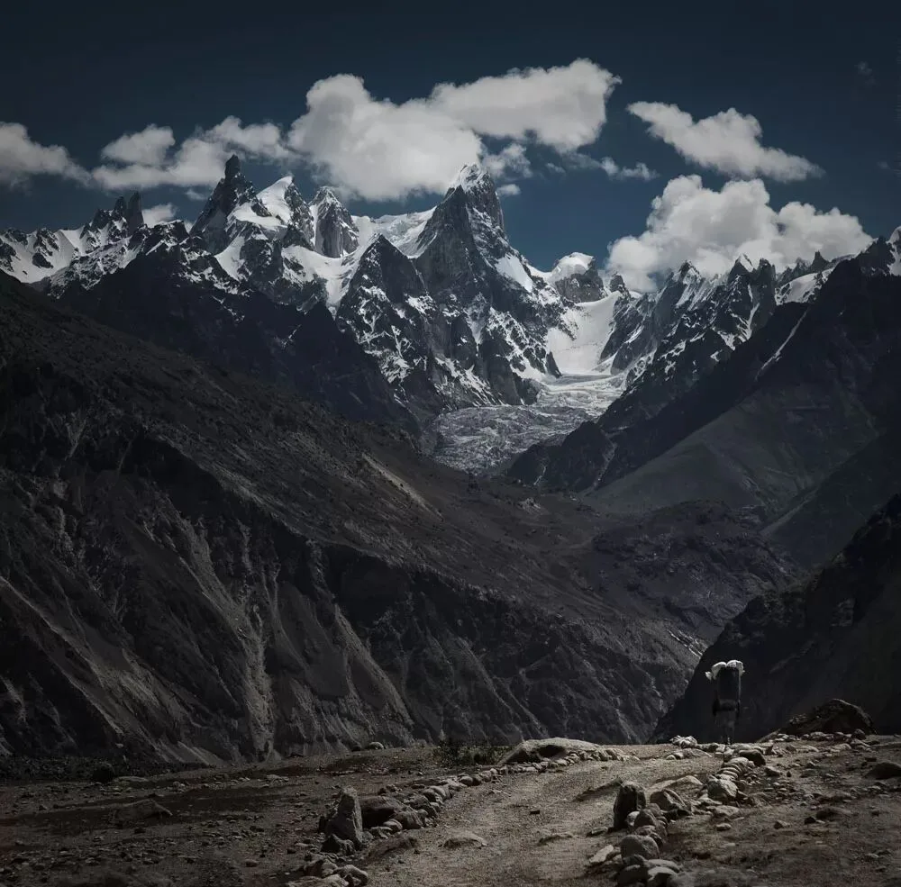
At noon, we had a roadside meal in a small grove. I mixed canned tuna into a fruit can, and this unique eating method left an indelible impression on my teammate Shi Fei. Later, my practice of sprinkling milk powder on Pakistani flatbread and eating them together also stunned him — one of the amusing anecdotes of this trip.
Compared with the unbearable scorching morning, the afternoon trek was even more punishing. We watched the destination right before our eyes, yet had to cross mountains and ridges, detour around countless small peaks of varying heights — circling, climbing, endlessly, exhausting both body and mind.
In the evening we reached Jula camp, but we didn't rest. We kept searching everywhere for foregrounds, trying to include flowers, rivers, rocks, and so on, to set off the thumb-shaped Bakhordas peak in the distance.
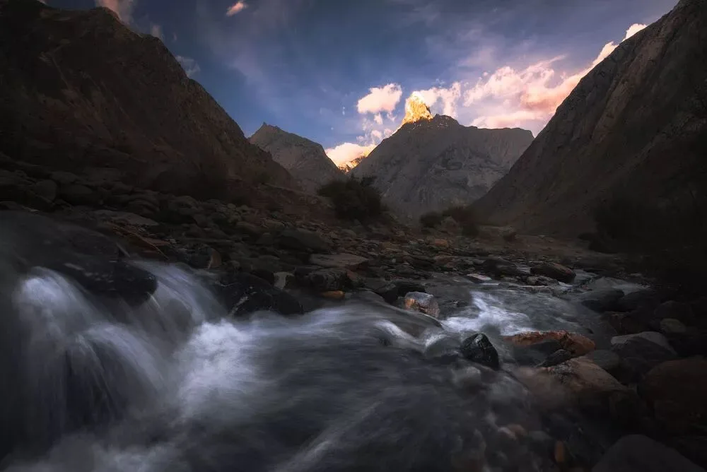
On the second day of trekking, we continued upward along the dry river valley until we stood before the Baltoro Glacier, the fourth longest in Pakistan.
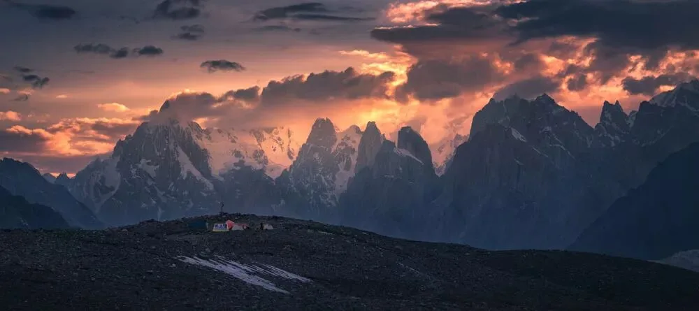
At the Paiju camp, we could see the distant Paiju peak, the Great Trango Tower, the Cathedral Peak, the Uli Biaho Towers, and others lined up one after another — majestic, perilous, and wild, looking especially magnificent under the setting sun!
Stepping Onto the Glacier and Shooting the Peaks Madly
Searching for the Blue Beauty in the Wild Land
The third day's trek was very hard: not only was the distance the longest at 24 kilometers, but we also stepped onto the glacier for the first time, trekking on zigzag gravel paths.
In many people's minds, glacier trekking means walking on pristine ice and snow wearing crampons. But in the Karakoram it's different: most of the glacier here is covered with yellow-gray rubble, with only small portions revealing its natural white-with-a-hint-of-blue appearance.
To cross it, we not only had to balance carefully on the gravel paths, but also jump over large rocks and leap across ice crevasses of all sizes. Many crevasses were bottomless — drop a stone in and you could still hear it clattering for more than ten seconds.
Though every step was hard, the extreme scenery along the way — undulating peaks, rising clouds and drifting mist — comforted us a lot. Along the way, everyone walked, stopped, and pressed the shutter madly; I was no exception.
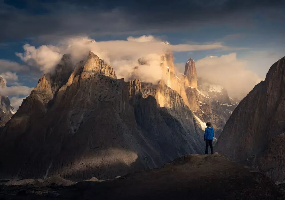
At that moment, the distant Trango Towers range was clearly visible, with sharp, defined ridges, and a large mass of clouds surrounding the summits and their backs — a fresh, magnificent scene that lifted the spirits. But in a two-dimensional photo, viewers can't intuitively feel the majesty of the snow mountains. So I had a teammate in a red shell jacket climb a high slope to serve as a reference for the Trango Towers. With a concrete sense of scale, readers can directly feel the grandeur of the peaks through the photo.
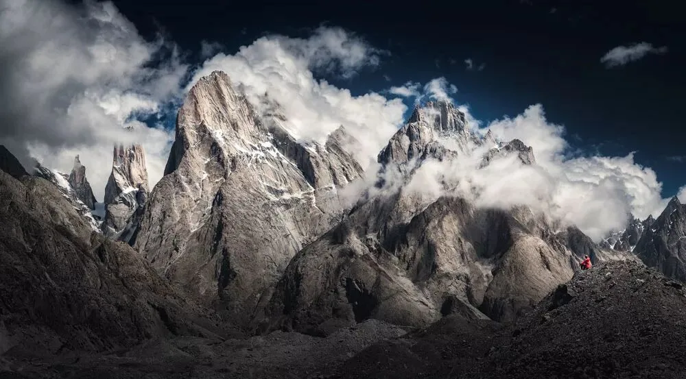
To further strengthen the image's impact, I selected 3 wide-angle photos for panoramic stitching, with each photo overlapping 50%. In post, I further reduced the saturation and brightness to emphasize the desolation and splendor of the Trango Towers.
In addition, it's worth mentioning that the main peak of the Trango Towers — the Great Trango Tower — stands 6,286 meters tall with a nearly vertical rock face, making it one of the high peaks the world's top climbers want to conquer.
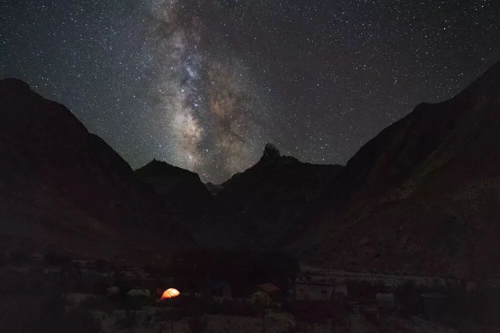
That day, we trekked until 4 p.m. before reaching the new camp. By day, the tents on the yellow sand and gravel looked rather desolate, but at night, the glowing tents transformed into a 10-star ultra-luxury hotel: the sky deep blue and pure, stars twinkling, with glaciers as the bed and snow mountains as the blanket — perfect for heart-to-heart talks about life!
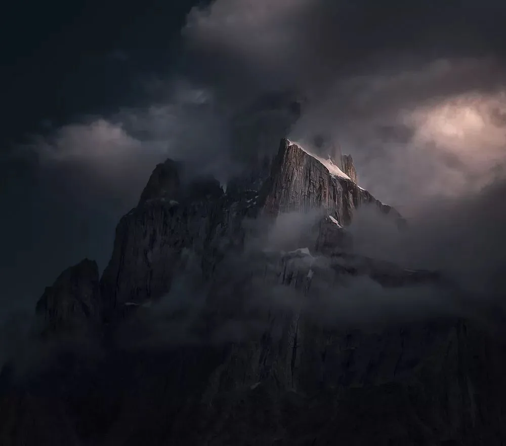
However, I didn't rest; I kept tirelessly exploring and framing. I chose one peak for focused shooting: the sky was heavy with dark clouds, and the towering peak rose like a drawn blade, yet its walls were covered with countless yellow-black crevasses that sheathed the peak's edge, making it deep and unclimbable.
Compared with the third day, the fourth day's trek was quite easy — we covered the 8-kilometer distance in two hours, reaching Urdukas, the camp we all agreed was the most beautiful.
Urdukas sits below an oasis and above a glacial lake, with flowers blooming brilliantly all around, making this uninhabited place seem like a paradise.
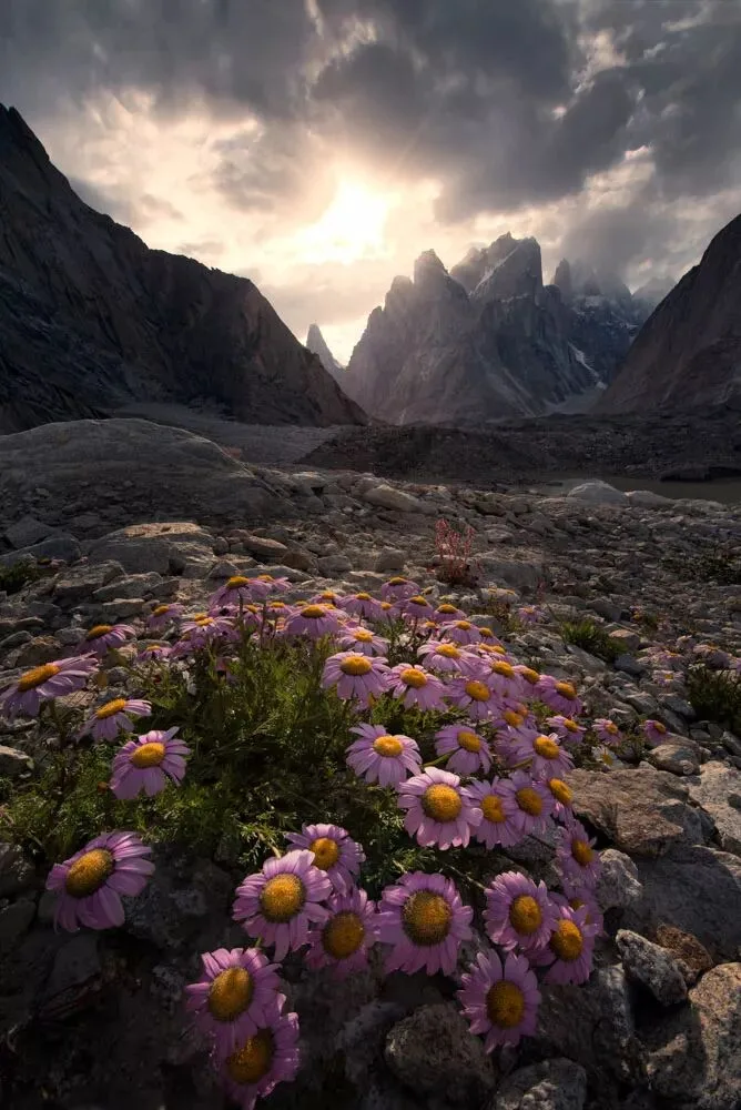
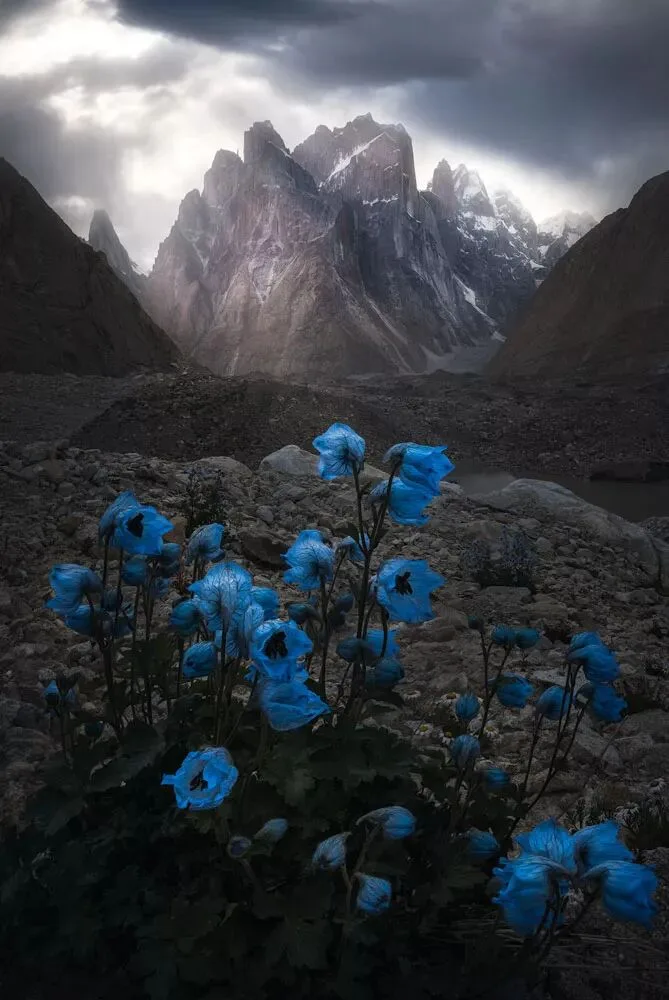
After setting up camp, I immediately searched carefully on the nearby rocky slope. After a long while, I finally found a large cluster of Kashmir delphinium wildflowers, whose eerily enchanting blue petals looked like leaping "flames" — breathtaking beauty and vigorous life filled me with joy.
I set up the tripod low, bringing the lens close to the flowers — only about 20-odd centimeters away. I first shot 5 focus-stacked photos to record the entire sharp image from front to back, then underexposed for the sky to capture the details of skylight pouring through the clouds and spreading across the peaks. Finally, I merged all the photos in post-processing software to produce the widely loved photo "Blue Beauty" (《蓝色妖姬》).
Urdukas camp once suffered a serious rockfall accident with several casualties. We saw many boulders that had rolled down the mountain near the camp and prayed that no accident would happen. Carrying this anxious feeling, I stood atop a boulder and felt one step closer to K2.
Going Deep Into the Glacier's Heart to Discover the Hidden Realm of the Ice River
The Thrilling Crossing of a High Mountain Pass
The previous days' camps were at the edge of the river valley or the glacier, but on the fifth day we crossed glacial streams, passed through ice pinnacles (seracs), and came directly to a camp deep in the heart of the Baltoro Glacier.
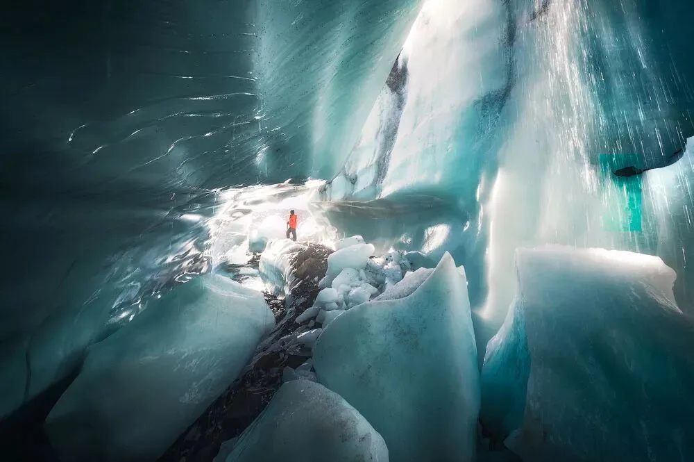
Under the intense sunlight, meltwater mixed with snow blocks cascaded down like rain, making the pure-white hidden realm beneath the ice pinnacles even more enchanting.
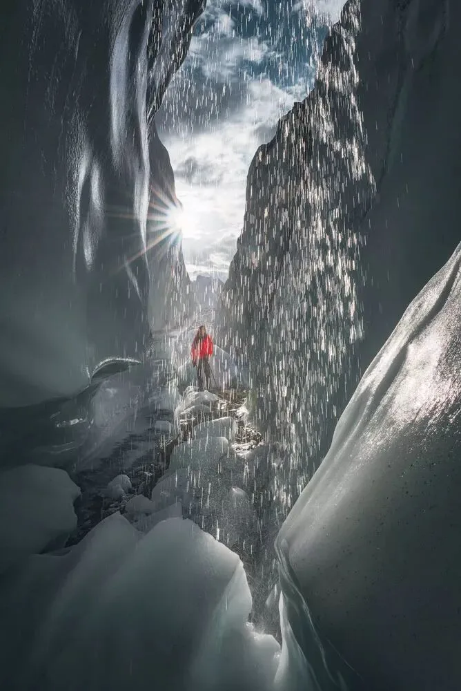
Since a thin layer of rubble lay over ice hundreds of meters thick, even inside the tent we could directly feel the oppressive chill radiating from the ten-thousand-year-old deep ice beneath us. Yet thinking that we slept alongside the myriad shapes of ice pinnacles, the wild rugged snow mountains, and countless stars, it had its own unique atmosphere.
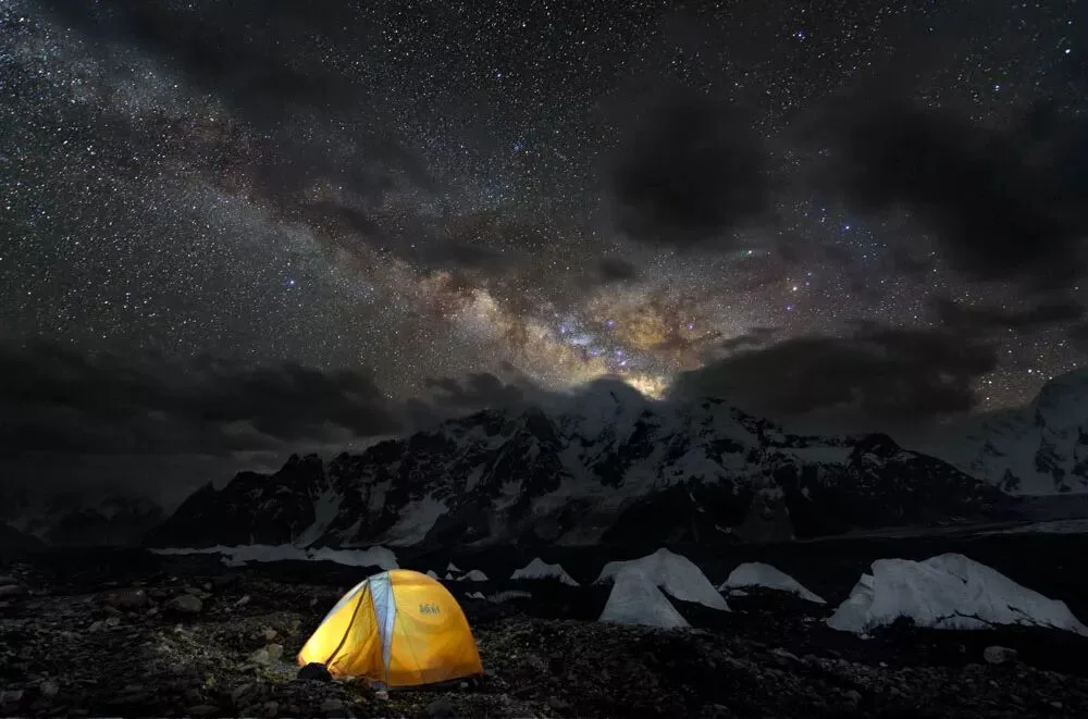
Crossing boulder fields and the icy glacier, we continued trekking for 7 hours to the famous camp — Concordia.
As the heart of the Karakoram range, Concordia is not only the confluence of 5 world-class glaciers, but also stands amid 41 peaks over 6,500 meters within a 15-kilometer radius, including 4 snow mountains above 8,000 meters such as K2. Concordia is therefore widely recognized as the world's one-of-a-kind showpiece of snow mountains — a paradise for glacier trekkers and mountaineers.
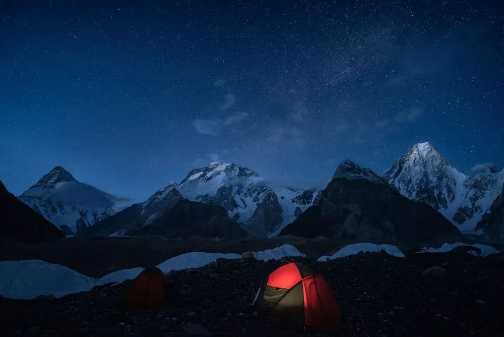
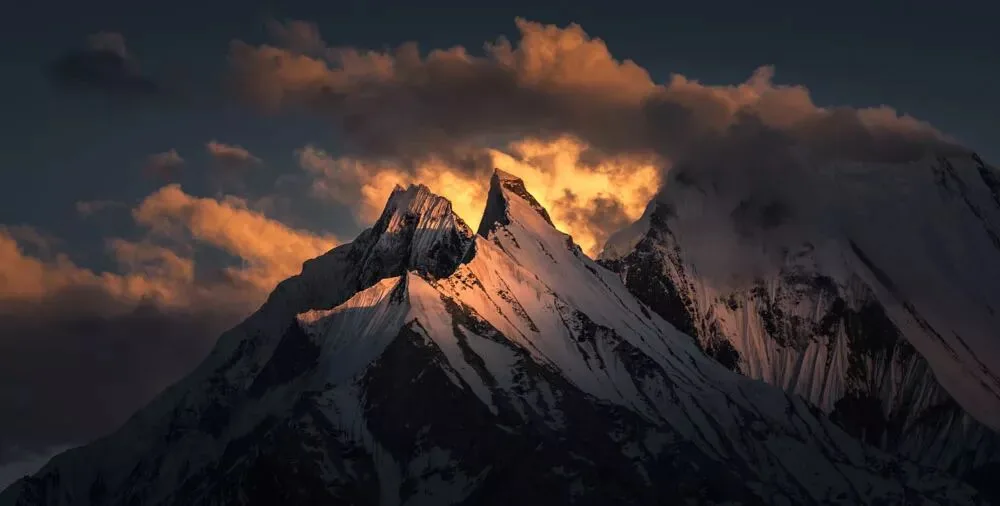
Moreover, the sunsets at Concordia are extraordinarily spectacular and stirring: sometimes burning like fire at the horizon, sometimes piercing the thick clouds to fall like holy light upon the rugged peaks, sometimes radiating brilliant rays and glowing hues... Whichever it is, in this wild land, it's enough to surprise and move people.
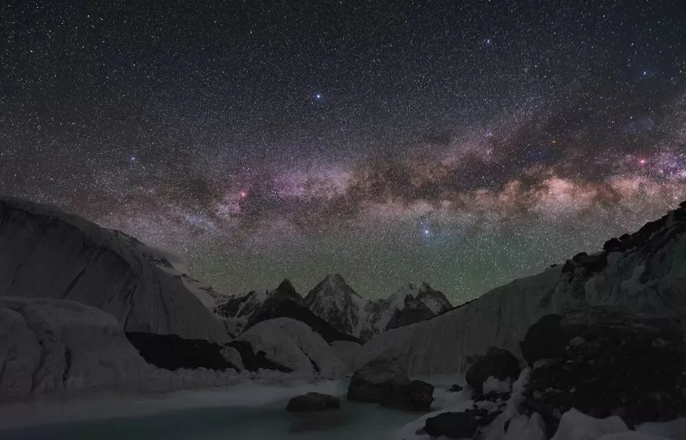
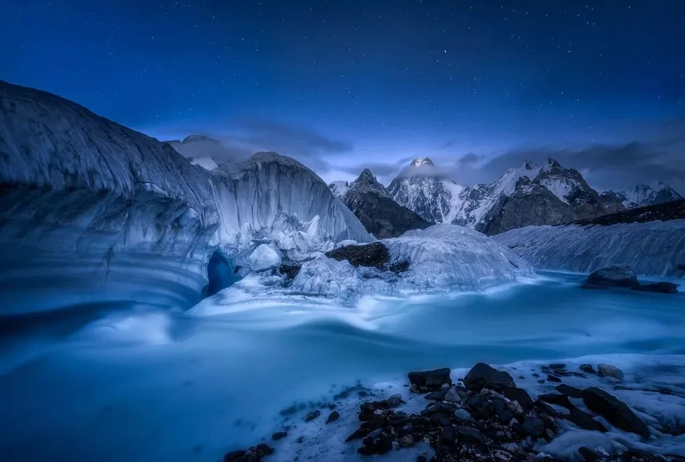
We explored near the camp, looking for various compositional foregrounds and shooting angles. To frame the distant Milky Way, the world's 12th and 17th highest peaks in the middle distance, and the Karakoram ice river in the foreground all at once, Shi Fei and I searched the crevasse-riddled heart of the glacier for an entire afternoon, finally finding a riverbank at a bend in the ice river.
To descend to the valley floor to shoot, we wore headlamps and, with the help of ropes and crampons, carefully lowered ourselves step by step onto the riverbank. The river's snowmelt rushed past, and steep ice walls rose on both sides. In that cold darkness, we quietly waited for the "Frozen Milky Way Valley" (《冰封银河谷》) to appear: the sky grew ever quieter, and the stars, brightening from dim like a stream, gradually gathered in a cobalt-blue curtain. I exposed the foreground for 5 minutes to completely fog the water and mist, revealing a mesmerizing deep blue that stirred reverence.
Returning from the shared base camp of Gasherbrum I and II, we were more than halfway through our itinerary. There were two routes back: one was to return the same way — simple, but taking 6 to 7 days; the other was to cross the Gondogoro La pass at 5,700 meters, enter another valley, trek 3-4 days to the town of Hushe, then take a vehicle back to Skardu.
In 2016, due to military control, the pass wasn't open. It wasn't until the following year, when we retraced the "K2" route, that we had the chance to cross this pass, which combined danger and awe.
Crossing the pass was especially hard — beyond the long physical exertion, there was the danger of high-altitude climbing. To catch the sunrise at the pass, we set out from camp at midnight. After climbing more than 600 meters, we finally stood atop the pass and enjoyed the spectacular "K2" sunrise.
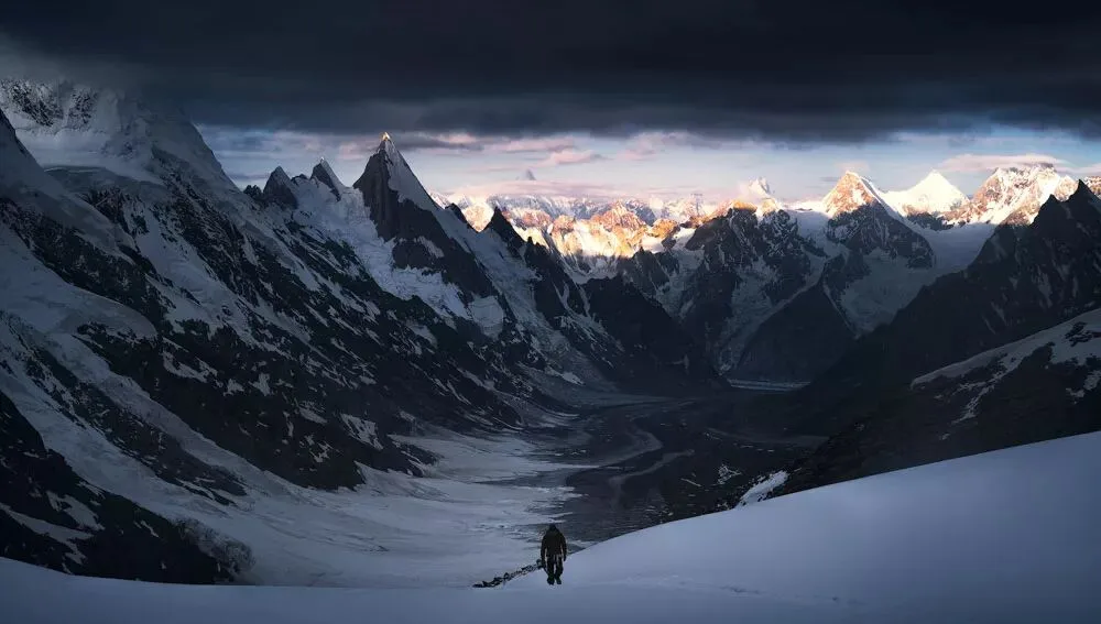
The pass was broad and vast, surrounded by firmly towering peaks, almost all with knife-point summits, their dark bodies covered with hard ice. In the distance, sunlight fell on some summits, showing gold and white — those few streaks of hopeful brightness echoed the dark grandeur up close, and the majestic power of nature was awe-inspiring.
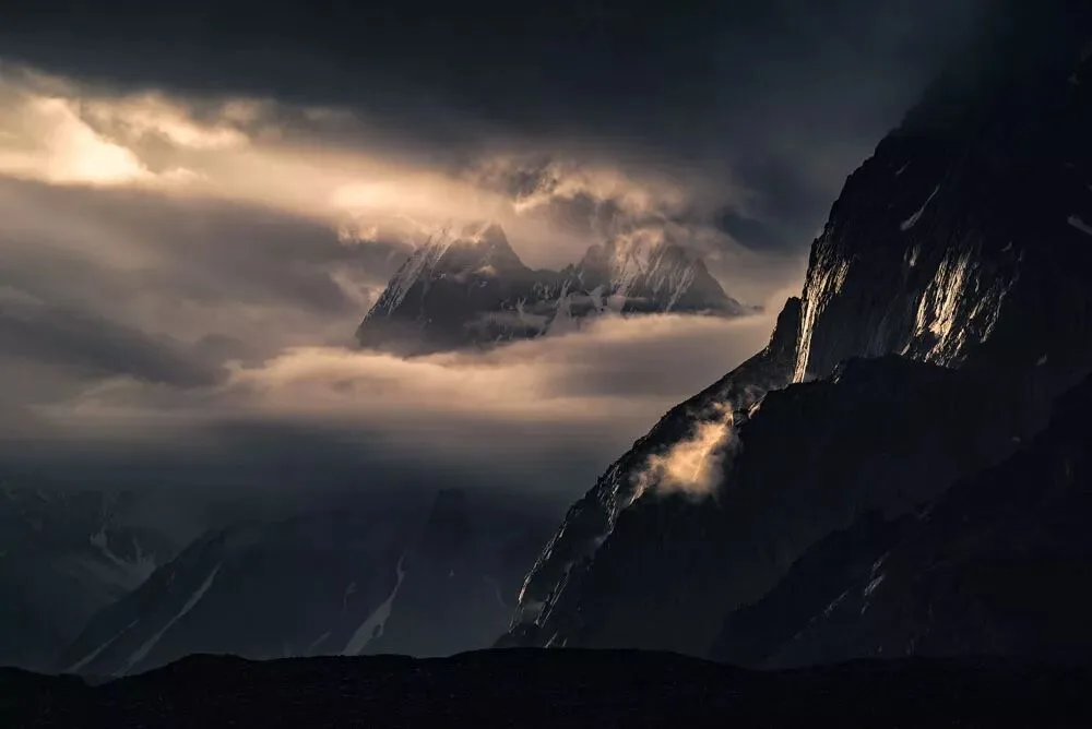
Going up was hard, but going down was harder. Facing slopes near 60 degrees, we relied on ropes and harnesses, nervously passing through several sections of frequent rockfall. At one point, teammate Shi Fei nearly had a slip-and-fall, scaring cold sweat out of all of us. After descending over 1,000 meters, we reached the alpine meadow camp beyond the pass (the Khuspang camp).
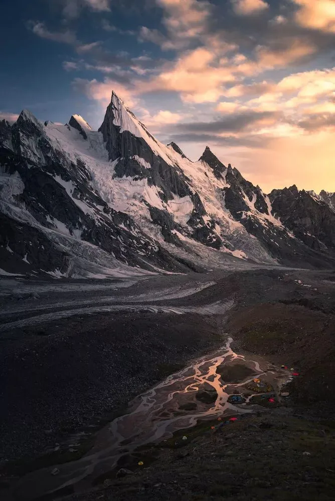
The Karakoram range is known for its desolation and grandeur, yet the camp felt like a paradise — flowers everywhere, green grass like a carpet, and babbling streams. I lowered the lens close to the ground again, using the distant blade-like Laila Peak as the background, along with the golden ridge, the glacier covering it, and nameless flowers growing vigorously — making it all look like an oil painting, with a hint of Van Gogh's sunflowers.
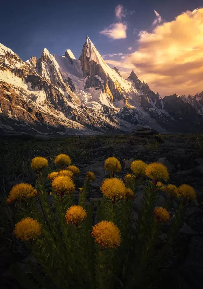
On the last day, everyone switched to sprint mode and covered a distance that normally takes 2-3 days. We rushed back to the town of Skardu and could finally take a proper shower!
Short film author: Ayu (阿裕)
Ayu (阿裕), a post-90s photographer, contracted photographer of 8KRAW, contracted photographer and contributor of Getty Images China. It took him only half a year from buying his first camera to signing with Getty Images China. His works include "The Tibetan Areas" (《藏地》), "Snowy Northeast" (《东北雪》), "Meeting You in Guangxi" (《遇见你广西》), and more.
Photos and text by: Thomas Chu Photo
Thomas Chu Photo — a post-90s professional landscape photographer and round-the-world traveler, author of the best-selling photography textbook "The Fundamentals of Landscape Photography Post-Processing" (《风光摄影后期基础》), a contracted photographer for Sony, Hasselblad, and Haida, a sample photographer for the DJI Mavic Air and Huawei P20, and a member of the AdventureX team.