Photography Tutorial · 2019-06-16
How Was the National Geographic Award-Winning Photo Made? The Photographer Reveals All
Thomas Chu Photo
As the grand prize winner of the 2019 National Geographic Travel Photographer of the Year contest, Thomas was recently interviewed by National Geographic magazine, sharing my story in Greenland and the creative process behind the winning photo.
Today, Thomas has compiled and translated the full interview, hoping it will be helpful to everyone. The first two questions cover background; the creative process behind the winning photo is in section 3.
Photographer Background
Sarah:
Can you talk about your background as a photographer/enthusiast? When did you start photography?
Thomas:
I was born in Chongqing, China in 1990, and grew up in this city of beautiful mountains and rivers, which gave me a natural closeness to nature.
In 2011, while in university, I bought my first DSLR — a Nikon D90. During my exchange semester in Munich in my sophomore year, the beauty of the Alps made me fall in love with the outdoors and travel.
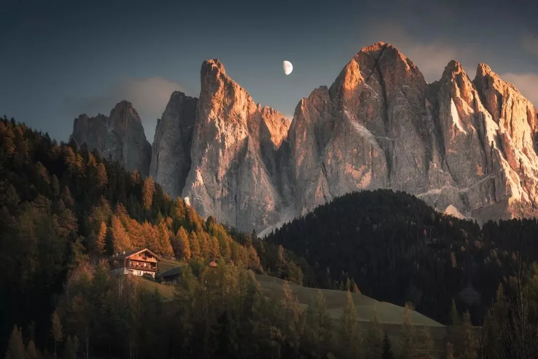
Moonrise over the Dolomites, Italy
I found photography to be a great way of sharing what I saw and thought on my journeys, and gradually combined the two passions of travel and photography.
In mid-2017, after graduating from university and working full-time as a software engineer for 3 years, I made an important decision: to become a professional photographer. I believe that when you're young you can afford trial and error — you should bravely try different paths and pursue what your heart truly loves.
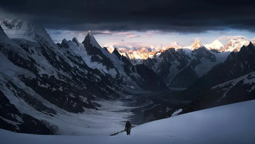
Pakistan — a teammate climbing a 5,900-meter mountain pass
After becoming a professional photographer, my main subjects have been outdoor landscapes typified by snow mountains and polar regions, along with the indigenous people and explorers within them. Every year I travel to Greenland, Pakistan, and around China for my long-term projects.
I hope to help more people learn about these places, and to love this magical and vast world a little more.
Background on the Greenland Series
Sarah:
We hear this was already your third trip to Greenland? How did you learn about Greenland, and how long did you shoot there?
Thomas:
In 2016, I saw a set of Greenland fjord photos by Dutch photographer Max Rive, and later read the exploration reports of adventurers Willem Vandoorne and Joery Truyen there. It felt incredible — I was completely stunned by the unique landscapes.
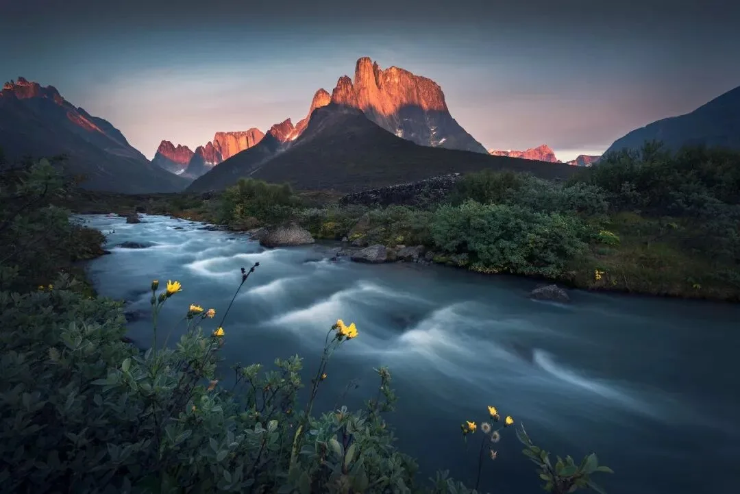
Fjords of South Greenland
So from mid-August to mid-October 2017, I set foot on this Arctic land for the first time. I spent 2 months exploring the uninhabited fjord region of South Greenland on foot and by boat.
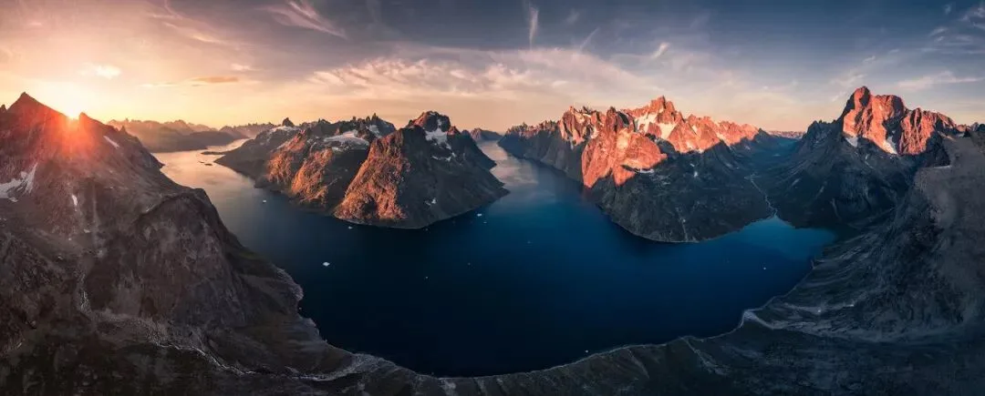
Aerial panorama of Greenland's fjords — three canyons converge here
For example, one unexplored deserted island: my teammate and I analyzed Google Maps and identified this possible shooting spot — a U-shaped fjord junction surrounded by steep peaks facing east, promising spectacular fjord views.
Because one side of the fjord bend was an almost vertical cliff, with the help of local fishermen we landed on the other side of the island and hiked for two days to reach this summit, where we captured the grand scene we had envisioned in software.
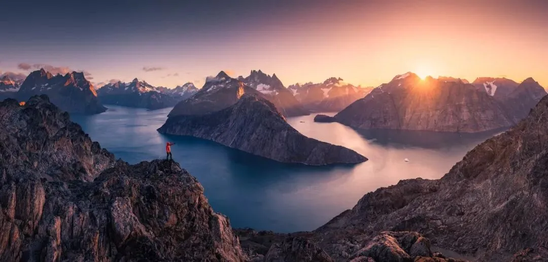
An uninhabited island in South Greenland
The photo below was the most dreamlike night of my two months hiking in Greenland.
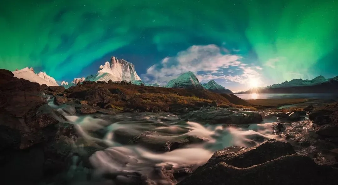
Greenland — aurora and moonset panorama
In autumn 2018, I explored South Greenland again. When shooting in the wilderness, we would usually restock food in small fishing villages and travel on the villagers' fishing boats. Over time, I became interested in Greenland's unique villages, architecture and culture.
The photo below was taken at my lodging in the village of Tasiusaq. This tiny fishing village has only 50 people, and the young keep leaving for larger towns. I stayed in the house of the village's elementary school teacher.
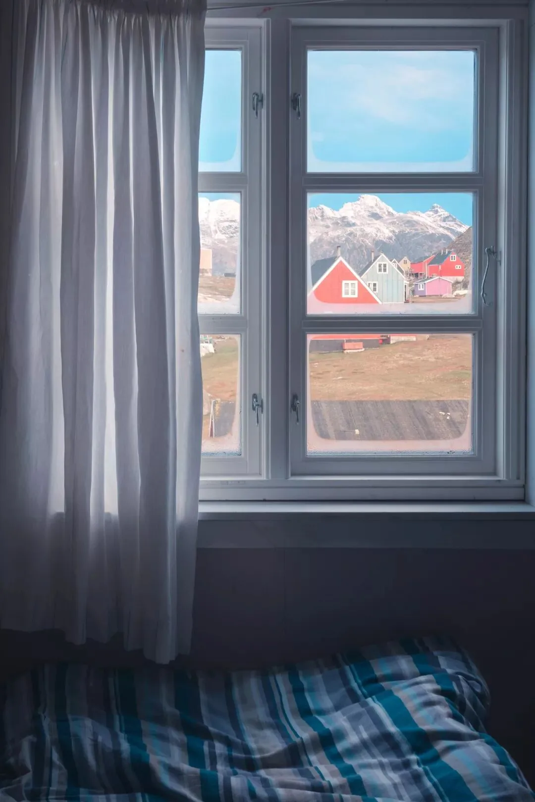
A Greenlandic home
Another small fishing village in South Greenland, Narsaq Kajulleq — the rain-drenched peaks in the distance looked like a Chinese ink painting. I was drawn to the feeling of isolation of these Arctic fishing villages.
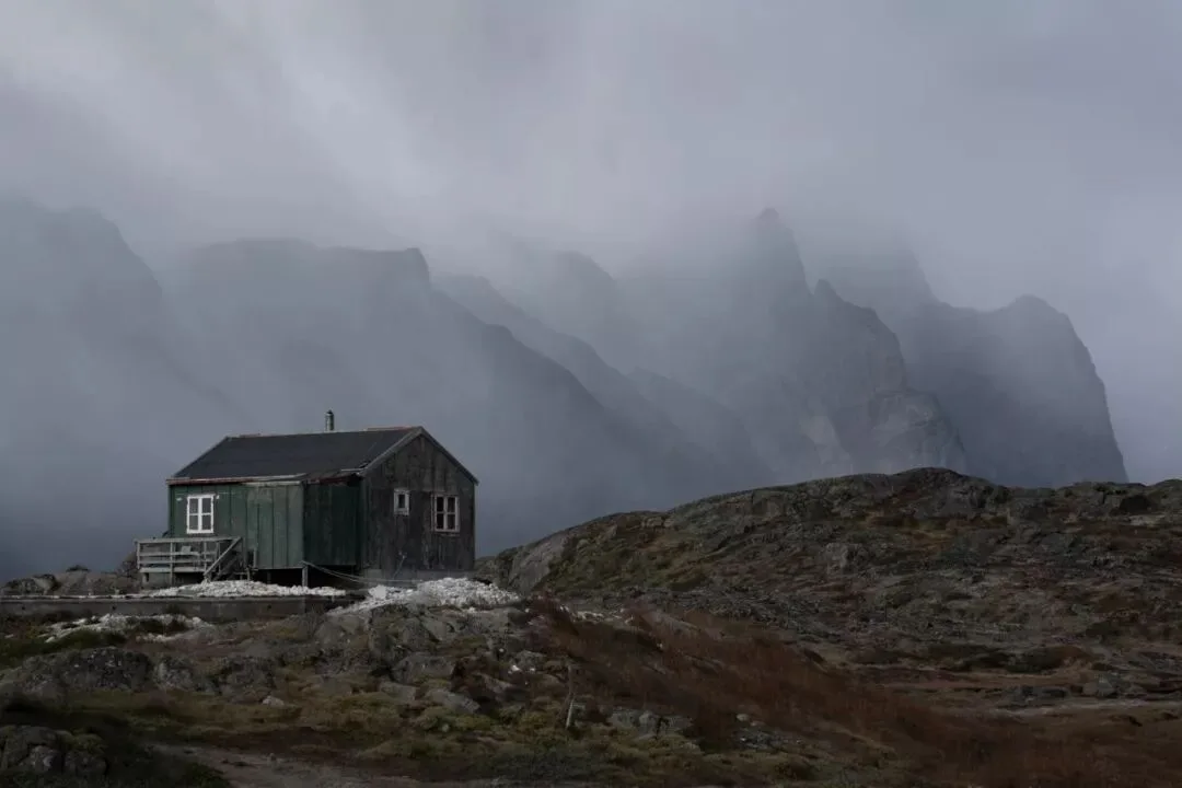
A Greenlandic town in the rain
Fishing and hunting are the main ways these villagers make a living. In Greenland, seafood is incredibly cheap compared to imported vegetables and fruits — we even bought a cod of over five kilos from a local fisherman for 50 RMB. Fishermen often work at dawn and dusk; the photo shows someone walking through town in the early morning.
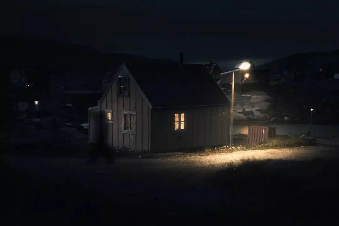
A Greenlandic fishing village at dawn
So by 2019, I decided to set natural landscapes aside for the moment and focus on photographing Greenland's local communities.
I chose Greenland's largest city Nuuk (the capital), the tourism hub Ilulissat, and several small fishing villages where locals congregate — Upernavik, Aasiaat, Qasigiannguit — as my key subjects.
From these villages of varying openness, one might discover different ways of life and the influence of outside culture on the local one.
In some larger Greenlandic towns, people have built beautiful modern apartment buildings. The photo below is like a geological cross-section, reflecting the changing urban landscape.
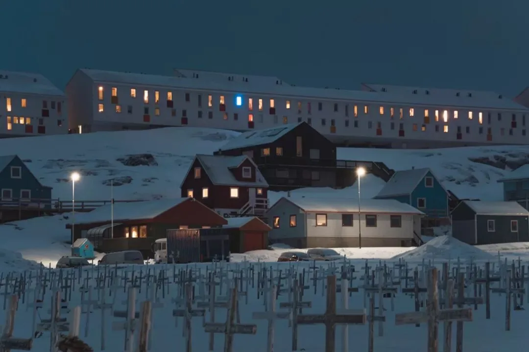
Nuuk — modern apartments on the hilltop with traditional buildings in front
When choosing when to travel, I picked March — the coldest time of year in northwest Greenland, with average temperatures below -20°C.
I wanted to see how local people live during the harshest season of the year. I had also rarely photographed snowy scenes before, which was an interesting challenge.
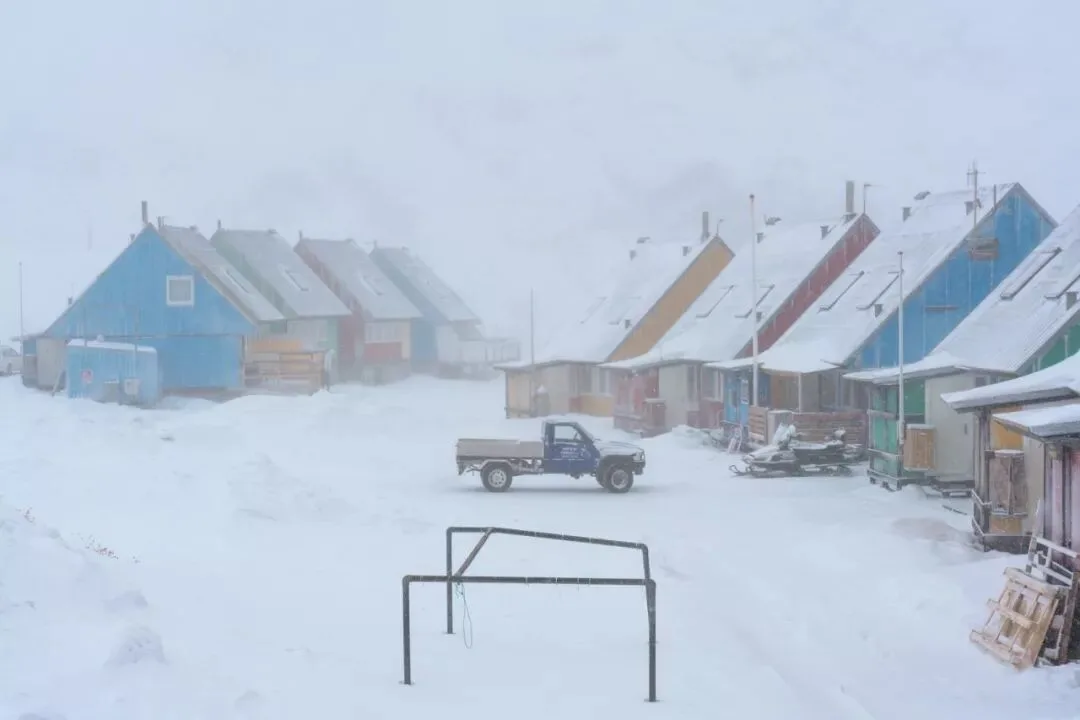
Ilulissat — a car parked in the snow.
Sarah:
What exactly is it about Greenland that attracts you and keeps you going back?
Thomas:
What I love most is Greenland's feeling of standing apart from the world, that utter seclusion.
In Greenland I met many people who had immigrated from Denmark, the Philippines and even Japan; they all love the simple, quiet life here. For those who enjoy solitude, Greenland is a treasure.
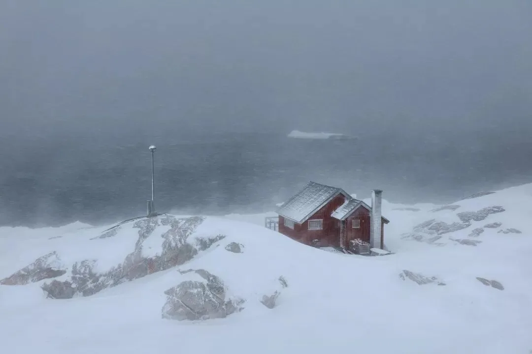
Ilulissat in a snowstorm — it feels like the end of the world here.
The photo below shows us on a local fishing boat reaching the end of an 80-kilometer fjord; in the distance lies the Arctic's permanent ice cap — nearly 2 million square kilometers, averaging over 1,500 meters thick.
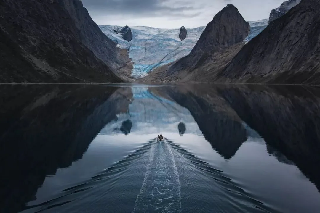
An Arctic fjord
The locals are extremely friendly and warm. In the photo below, an elderly couple waves to me through their window while I photograph on the street.
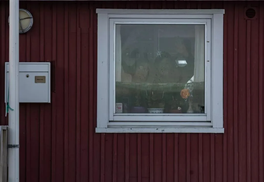
Greenland — warm-hearted locals
The Making of the Winning Photo
Sarah:
Tell us about the circumstances when you created the winning photo.
Thomas:
This photo was taken during the week I spent in the town of Upernavik.
Upernavik is Greenland's 13th largest town, with nearly 1,000 residents. It is also the center of the surrounding 9 villages and has the only airport in the area.
There are roughly 2-3 regional flights per week from here to Ilulissat, the hub of western Greenland — the town's only way of exchanging people with the outside world.
The whole town is built on an island, along a hillside, so it's narrow on top and wide at the bottom, looking like a Christmas tree. The town's highest point is a runway that handles small passenger planes.
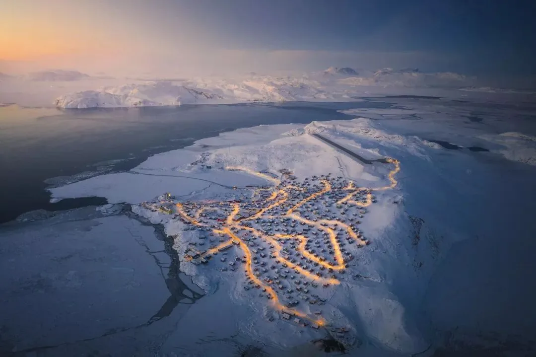
Aerial view of the town
In the past, people here painted their houses in different colors to distinguish their functions and even the owners' occupations — commercial buildings were red, fishermen's houses were blue.
In the cold winter, when the sea and ground are covered in white snow and ice, these houses become the only colors across more than 2 million square kilometers of Arctic land.
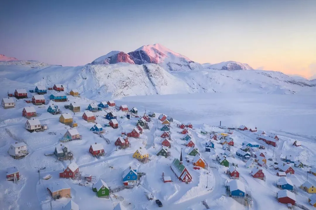
Arctic colors
The day of the shoot was snowy and windy, around -20°C. Actually, the period of my visit was considered a 'warm winter' by locals — because temperatures weren't low enough, the sea ice was cracking and melting, making it very dangerous for fishermen to drill holes and fish on the ice.
The fishermen told me that in recent years, perhaps due to climate warming, such 'warm winters' have become increasingly common.
An Eastern European explorer I met in Upernavik had been packed and ready, planning a 300-kilometer trek over the sea ice to the region's most remote village. But the unstable ice forced him to keep waiting in town.
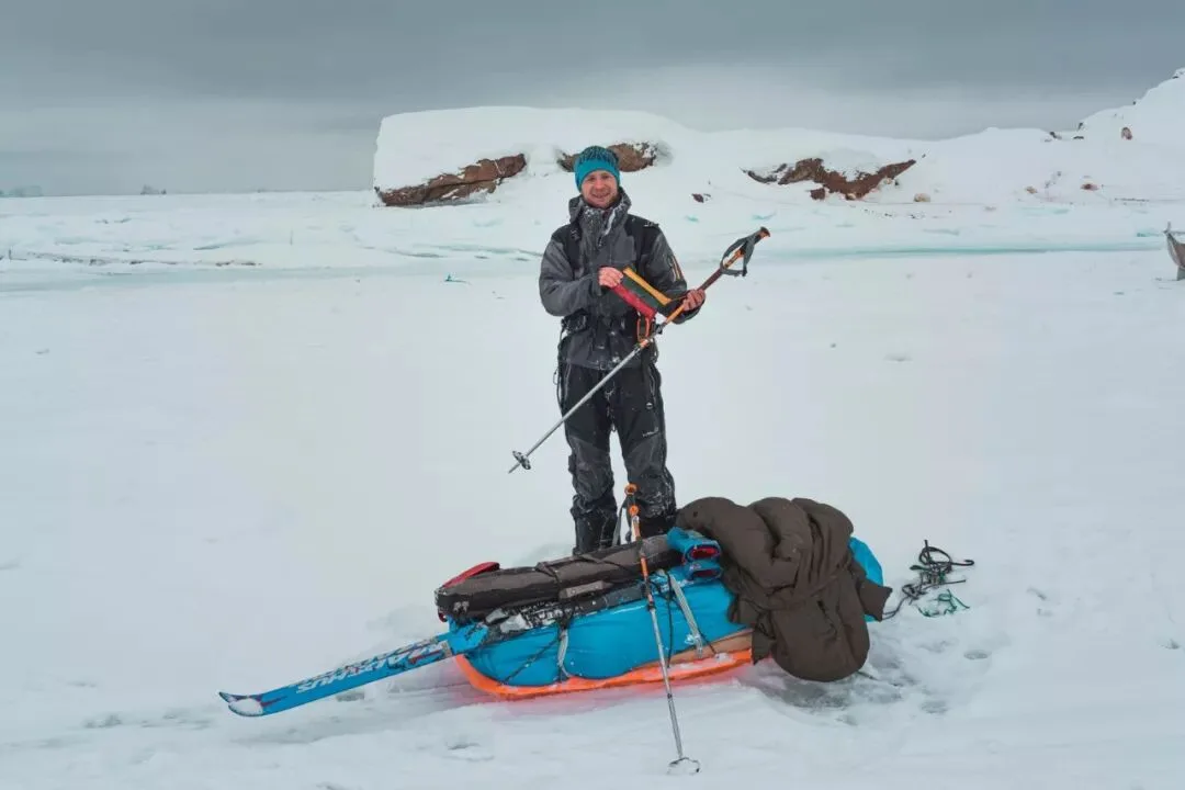
The Eastern European explorer
Over the course of a week, I walked nearly every street and alley here. On a hillside near the airport, I found this telephoto shooting angle. I loved its structure, colors, atmosphere and sense of layering — especially after the lights came on at night, it looked truly dreamlike.
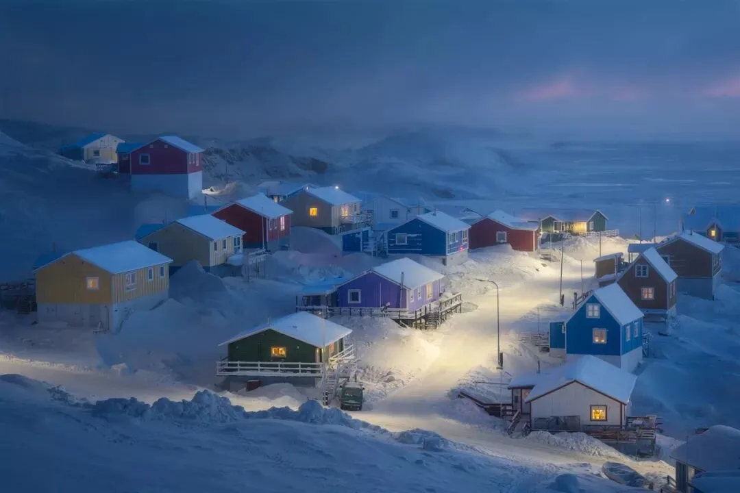
A street in Upernavik
I started by shooting at ISO 200 with a 5-second long exposure, which produced a clean, dreamlike scene.
But I felt this scene only recorded the buildings and environment — it lacked vitality. If I could include the activities of local people in the photo, it would give viewers more information.
So I decided to capture the locals' activities too. But this was no easy task — the lights were already on and the ambient light was very dim.
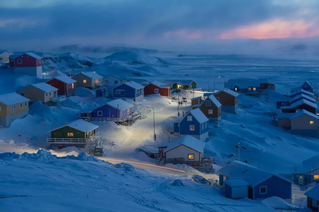
A failed attempt — the people are all blurred
On one hand I needed a shutter speed fast enough to freeze people's movement; on the other, I couldn't push the ISO too high or there would be too much noise.
I had to carefully keep the balance on the scale between 'catching the moment' and 'excellent image quality'.
After several failed attempts, I finally settled on ISO 3200, f/4, 1/50s exposure.
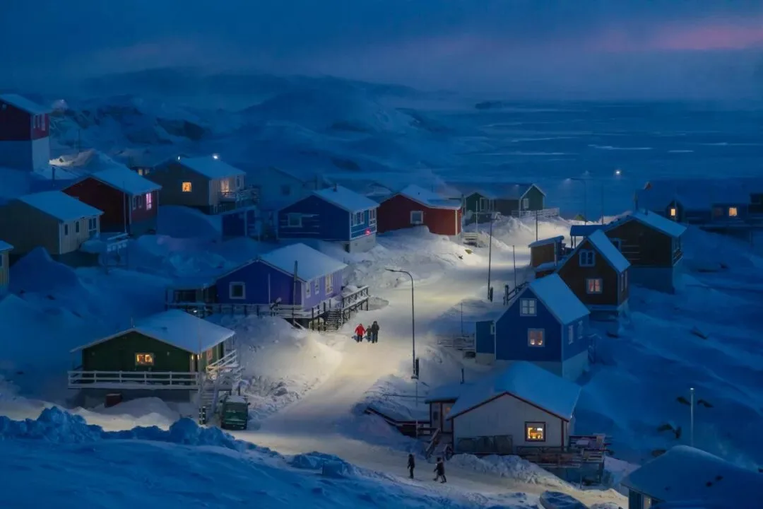
The successful capture
1/50s is almost the slowest shutter speed that keeps moving people sharp; ISO 3200 still gave usable quality. Although somewhat underexposed, the latitude of modern cameras lets me recover shadow detail in post.
Sarah:
Were there any unexpected surprises while shooting?
Thomas:
My shooting position was far from the street, so the locals were completely unaware of me, allowing me to record authentic moments of life.
I had originally imagined a lone pedestrian walking down the street, or a group of children playing. So the appearance of this family of three was completely unexpected.
That sense of the moment and of surprise is, I think, one of photography's unique charms. So I quickly switched to burst mode and started hammering the shutter.
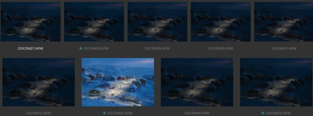
The burst sequence — the brightened frame is the one selected for submission
While holding down the shutter, I was also savoring the unique feeling of that moment.
On one side, thick snow and a white expanse of land — even the distant sea had become an ice field. And the blue tone of night made it feel even colder.
But the street lamps, the lights inside the houses, and the family of three on the road made me feel an extraordinary warmth.
I seemed to understand why the local people can conquer such a brutal natural environment and survive and thrive here.
I think it's because of the close-knit bonds of family and community. When locals go whaling, several or even dozens of boats head out together, and the catch is shared with all residents.
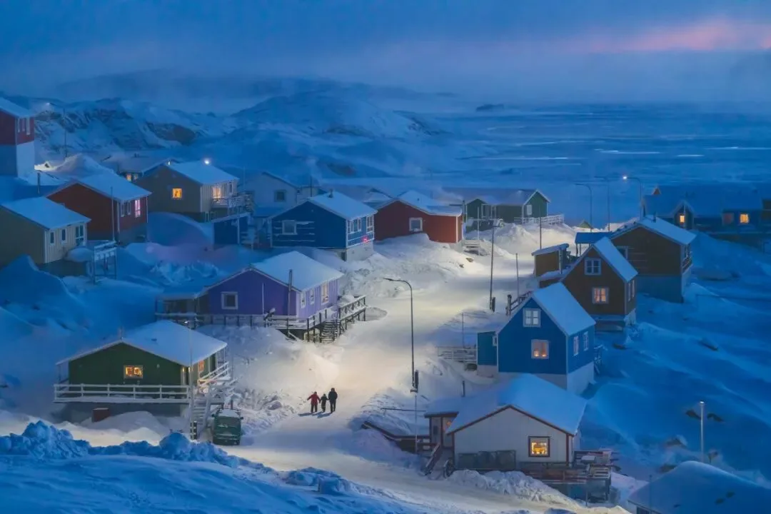
The final submitted photo
Sarah:
You just mentioned many shooting techniques, and many of your photos were taken with a drone. How have this modern equipment and these technologies helped your photography?
Thomas:
Of course, they help a great deal.
As mentioned, I used the latest Sony mirrorless camera. Its high dynamic range and ISOless characteristics (ISOless means brightening in post achieves the same image quality as raising ISO in-camera; new cameras generally have ISOless sensors) helped me record this decisive moment using only ambient light in a dark environment.
And after processing with modern noise-reduction algorithms, the image quality turned out quite good — unimaginable in the past.
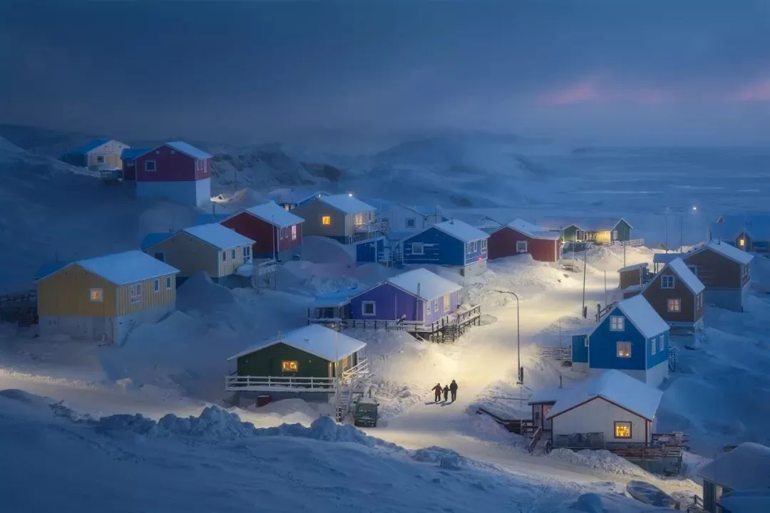
The social media version of the winning photo
Actually, when uploading to social networks and making prints, I have another version (above).
This version was created via 'time blending' — combining the people from the winning photo with the street background from another low-ISO long exposure. It has even less noise and still prints beautifully.
Of course, due to the contest rules, I could only submit the high-ISO single-frame processed version this time.
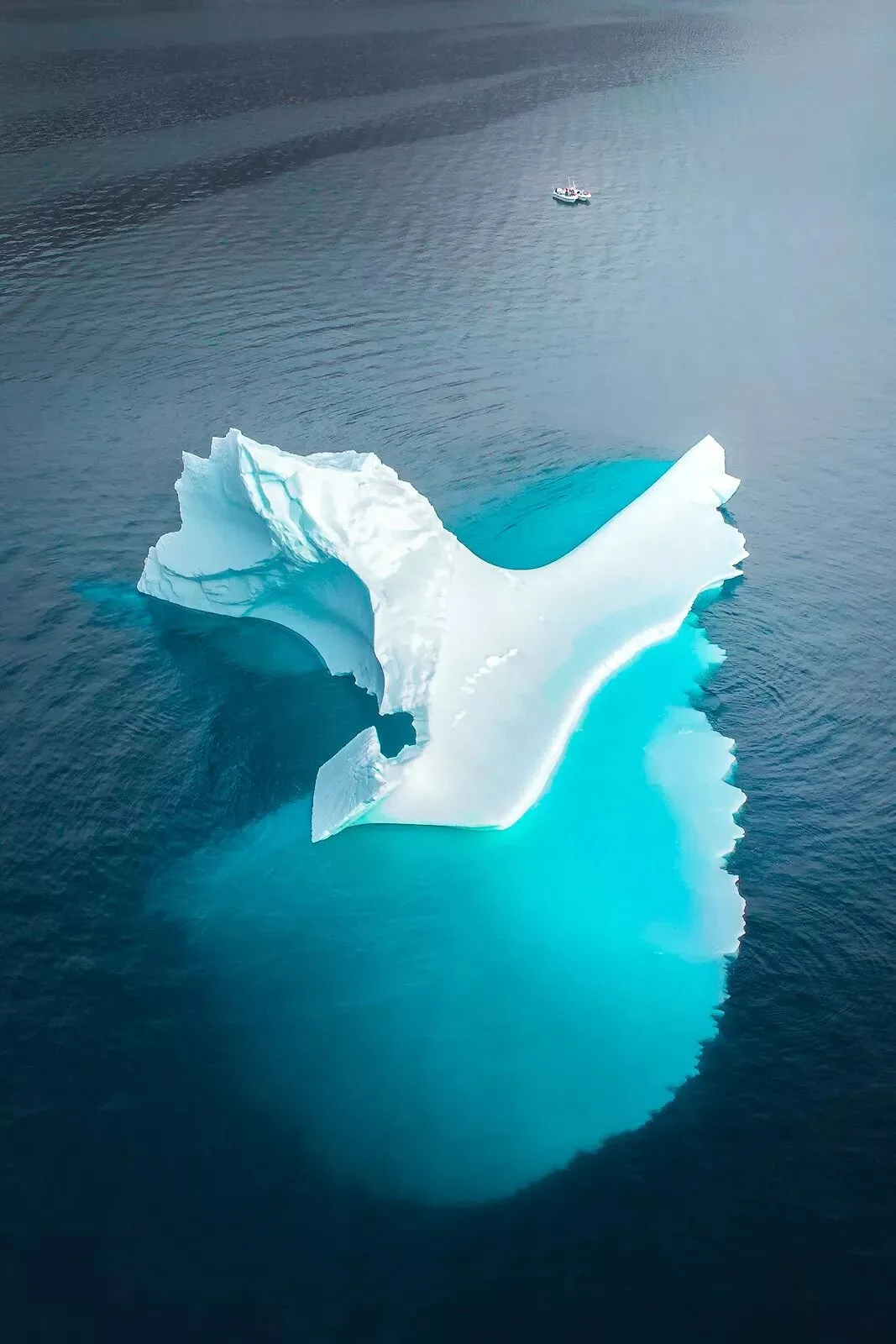
Drone shot of an iceberg — only from the air can you see the iceberg's massive underwater base
Drones are also among the modern technologies and equipment I used extensively in Greenland.
While complying with local regulations, the drone gave me almost complete compositional freedom — I could choose the best angle and position, even where no person could possibly stand.
In Greenland I used the drone to shoot numerous panoramas and bird's-eye views, and even took long exposures at night using the drone's 1-2 second stability window.
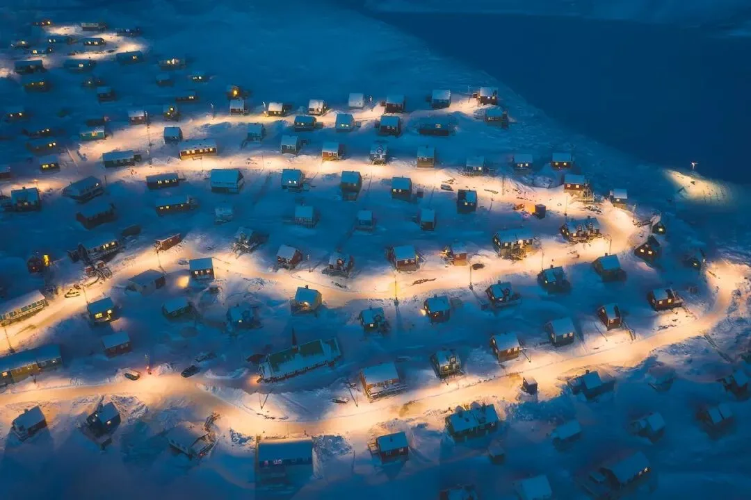
Long exposure night shot by drone
Of course, the greatest convenience the drone brought me was serving as my 'scout', providing 'shooting intelligence'.
When arriving at a new location, I usually fly the drone to a high point and take several panoramic photos.
Then I can zoom into the images on my laptop, carefully search for possible shooting spots, and circle them in red.
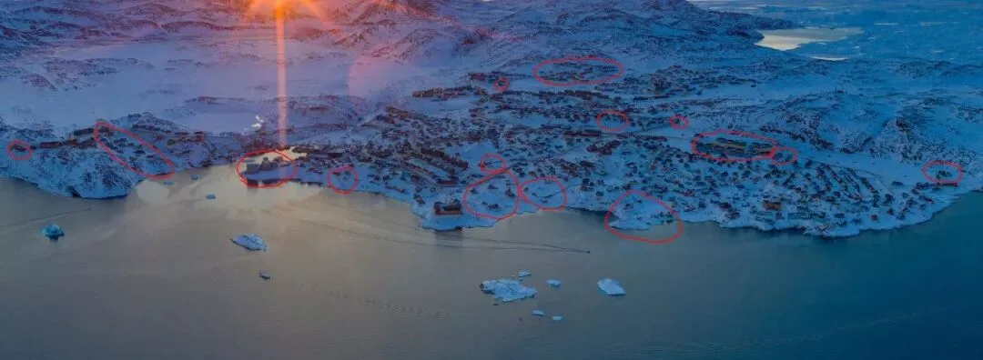
The drone 'intelligence map'
The image above is the 'intelligence map' I built with the drone in Ilulissat.
In the panorama I found buildings with local character, or special geometric structures and colors — all very suitable for photography — so I could scout locations on site with clear targets.
On this trip to Greenland, I focused on photos with that 'end of the world' feeling, so I also circled some isolated little houses by the sea as a basis for later exploration and shooting.
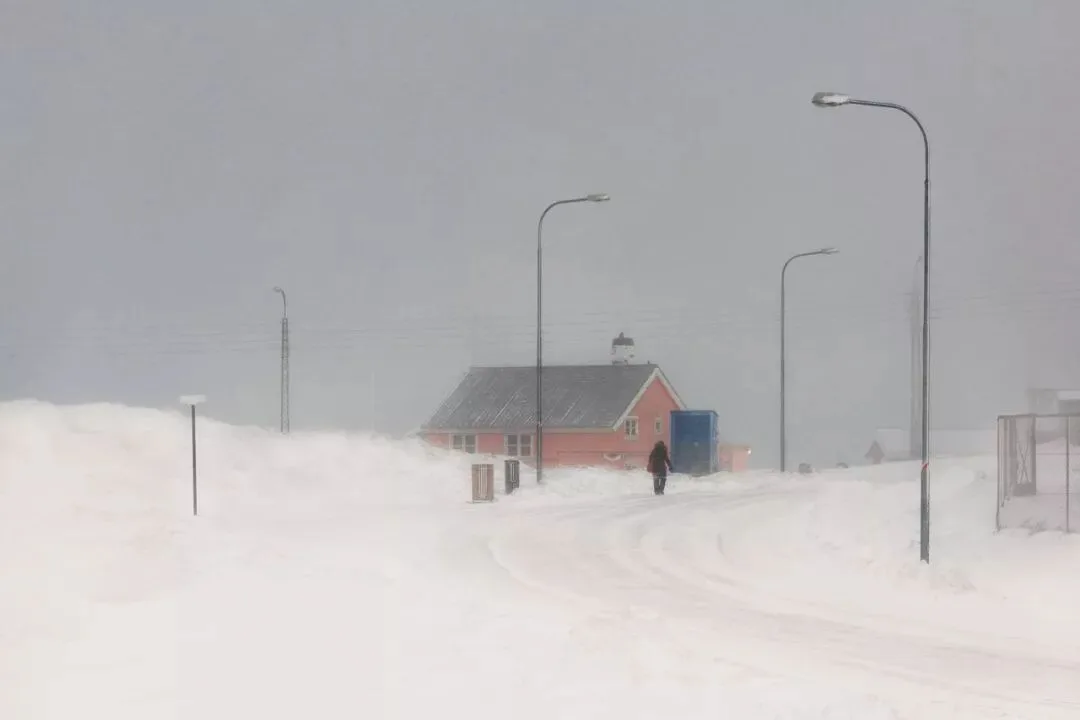
A shooting spot discovered through the drone
Sarah:
How did you decide to spend a week in Upernavik, and what surprised you most during that week?
Thomas:
Honestly, I hadn't planned to stay that long. My original plan was 2 days in Upernavik, then flying further north to explore Qaanaaq.
But when I searched for flights, I found that winter flights in Greenland were too few and basically fully booked by locals. Because of the tickets, I couldn't go further north, and I had to stay a week before a return flight was available.
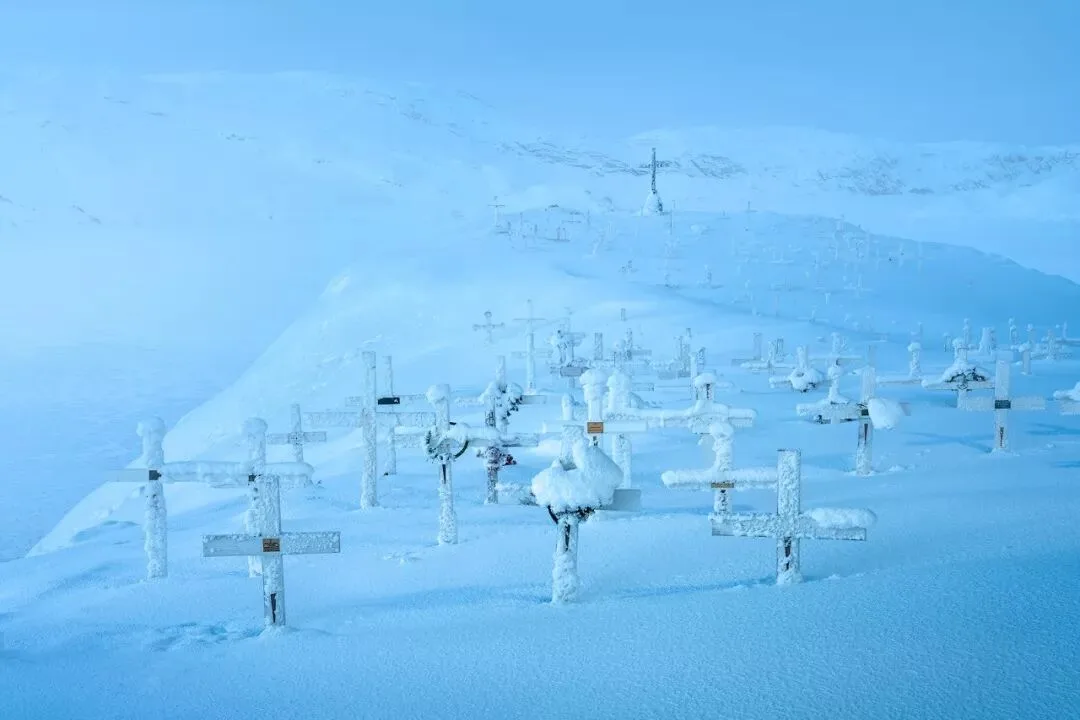
Upernavik — the snow-covered cemetery
Perhaps that was another kind of luck, because I hadn't expected the town to have so much worth exploring and photographing. I only captured the winning scene on my sixth day — under the original plan, I might have missed this photo entirely.
What surprised me most was the sight upon first arriving in Upernavik. Since tourists rarely visit, I found almost no photos of this town on the internet, and before going I had no idea what it looked like in winter.
The flight from Ilulissat to Upernavik takes about an hour, and the only scenery along the way is an endless white ice sheet and frozen sea. But then a dot of light suddenly appeared in the distance, growing bigger and bigger — that was the town of Upernavik!
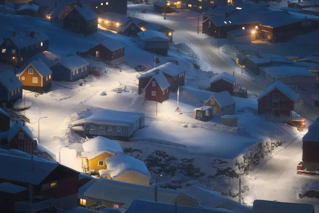
The town of Upernavik
As the plane descended, the burning waste disposal plant, the satellite communications station on the summit, and the dense colorful houses on the hillside unfolded one after another. I felt I had arrived in a fairyland and almost gasped out loud.
Words can hardly describe that beauty and shock. I shot a short video of the landing with a DJI Osmo Pocket to share with everyone.
Future Plans
Sarah:
Will you go back to Greenland? Do you have other shooting plans?
Thomas:
Of course. This winter's Greenland trip was really just an attempt.
I built connections with many local people there, which will be very helpful for my future shooting there.
And I've found some interesting themes and angles that I will explore more deeply in the future.
Pakistan and China are also regions I've long been following.
Pakistan is not only about war and chaos, and China is not only about smog. Through my future projects, I hope to change Western audiences' perceptions of these two countries.
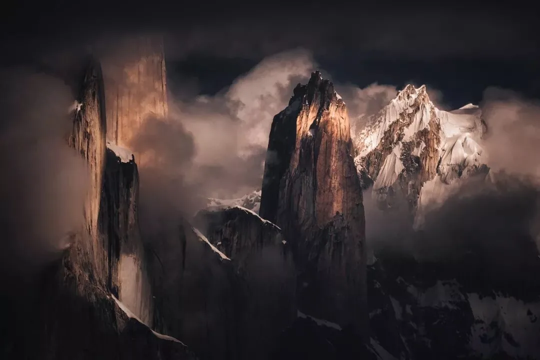
Trango Towers, Pakistan
Sarah:
Through which channels can people follow your work?
Thomas:
My Instagram account is: thomaschuphoto
My Chinese homepage is at thomaskksj.tuchong.com
You can see my latest photos there.
End of the interview — finally, let me share the gear I used on this trip.